|
search place name
|
||
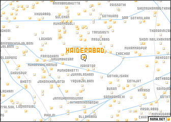
Haiderābād (Sind, Pakistan)Haiderābād is a town in the Sind region of Pakistan. An overview map of the region around Haiderābād is displayed below.
regional and 3d topo map of Haiderābād, Pakistan ::
Haiderābād airports ::
The nearest airport is SKZ - Sukkur, located 66.4 km south east of Haiderābād.
Other airports nearby include MJD - Moenjodaro (71.8 km south), SUL - Sui (121.9 km north east), WNS - Nawabshah (196.4 km south), Nearby towns ::
Īsa Kator (2.0km south) //
Shāhbāzi Mehr (2.3km south east) //
Kotri (2.7km north west) //
Dur Muhammad Lelāhi (3.1km north) //
Muhammad Qāsim (3.3km north east) //
Jumma Lashāri (3.9km south) //
Belāni Kator (4.1km north west) //
Gul Muhammad Khosa (4.2km north east) //
Mangla Lashāri (4.6km north) //
Khān Muhammad Khosa (4.4km north east) //
Punho Bhatti (4.5km south west) //
Khair Muhammad Wānd (4.9km north) //
Goth Kilch (4.7km south east) //
Rasūlābād (4.8km north east) //
Rasūl Bakhsh Brāhui (4.7km north east) //
Dādu Mahesar (4.5km west) //
Bahāro Khokhar (4.7km west) //
Yaqūb Jalbāni (5.4km south) //
Raīs Māin (5.6km north) //
Khudaābād (5.2km north east) //
Wānd Ganda (5.7km north west) //
Hāji Qādir Bakhsh (6.2km north) //
Taru Dasti (6.1km north east) //
Lāngāh (6.3km south) //
Raīs Kamāl (6.4km north) //
Murād Ali Brāhui (6.1km north east) //
Wassāyo Bhutto (6.7km south) //
Abdul Halīm Wānd (6.3km south west) //
Ghulām Muhammad Wānd (6.8km south east) //
[all distances 'as the bird flies' and approximate] 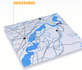 Places with similar names to Haiderābād, Pakistan ::
// Hāydarābād (BD)
// Haidarābād (IN)
// Hāderābād (IR)
// Ḩeydarābād (IR)
// Ḩeydarābād (IR)
// Ḩeydarābād (IR)
// Ḩeydarābād (IR)
// Ḩeydarābād (IR)
// Ḩeydarābād (IR)
// Ḩeydarābād (IR)
Disclaimer :: Information on this page comes without warranty of any kind |
||
|
Where is Haiderābād? Elevation and coordinates ::
Latitude (lat): 27°58'55"N Longitude (lon): 68°11'5"E
Elevation (approx.): 53m (map arrows pan, magnifying glasses zoom) |
||
|
Visiting Haiderābād? Hotel/Accommodation ::
Book a hotel in Haiderābād Travel Guide ::
Buy a travel guide for Pakistan rental cars ::
car rental offers GPS waypoint ::
download a GPX waypoint (PoI) of Haiderābād for your GPS receiver
|
||