|
search place name
|
||
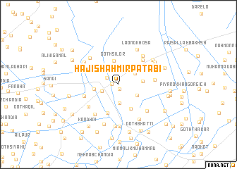
Hāji Shāhmīr Patābi (Sind, Pakistan)Hāji Shāhmīr Patābi is a town in the Sind region of Pakistan. An overview map of the region around Hāji Shāhmīr Patābi is displayed below.
regional and 3d topo map of Hāji Shāhmīr Patābi, Pakistan ::
Hāji Shāhmīr Patābi airports ::
The nearest airport is BDN - Talhar, located 51.3 km west of Hāji Shāhmīr Patābi.
Other airports nearby include WNS - Nawabshah (169.6 km north west), BHJ - Bhuj (187.1 km south), IXY - Kandla (217.8 km south), JSA - Jaisalmer (264.2 km north east), Nearby towns ::
Goth Bhugrio (0.8km north) //
Khair Muhammad Mughedi (0.8km south) //
Karm Khān Patābi (1.0km west) //
Ahmad Khān Khosa (2.0km north west) //
Pīr Bakhsh Khāskheli (2.6km south west) //
Mīr Ghulām Muhammad (2.8km north) //
Muhammad Ali Lashāri (2.9km south) //
Goth Nārāin Dās (2.9km north east) //
Goth Abdul Jalīl Unar (3.2km north east) //
Hāji Ahmad Amdāni (3.2km south east) //
Goth Silor (3.8km north) //
Saīd Khān Jamāli (3.5km east) //
Sulaimān Patābi (3.6km west) //
Goth Muhammad Ali Shāh (4.3km south east) //
Pīr Bakhsh Farm (4.7km south) //
Said Khān Lighāri (5.2km north east) //
Goth Sāwan Māchhi (5.2km west) //
Khān Muhammad Thahīm (5.2km east) //
Karm Ali Laghāri (5.7km north east) //
Mubārak Farm (5.6km south west) //
Ali Khān Laghāri (5.8km south west) //
Goth Ali Bakhsh (5.8km north west) //
Faqīr Siddīq Muhammad (5.8km south east) //
Lāong Khosa (6.2km north east) //
Goth Wadal Shāh (6.3km south east) //
Yār Muhammad Siāl (6.1km north west) //
Saindād Ghaliāni (6.6km south) //
Ahmadābād (6.2km north east) //
Goth Dūda Khān (6.7km south) //
[all distances 'as the bird flies' and approximate] 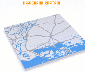 Places with similar names to Hāji Shāhmīr Patābi, Pakistan :: Disclaimer :: Information on this page comes without warranty of any kind |
||
|
Where is Hāji Shāhmīr Patābi? Elevation and coordinates ::
Latitude (lat): 24°56'55"N Longitude (lon): 69°19'55"E
Elevation (approx.): 10m (map arrows pan, magnifying glasses zoom) |
||
|
Visiting Hāji Shāhmīr Patābi? Hotel/Accommodation ::
Book a hotel in Hāji Shāhmīr Patābi Travel Guide ::
Buy a travel guide for Pakistan rental cars ::
car rental offers GPS waypoint ::
download a GPX waypoint (PoI) of Hāji Shāhmīr Patābi for your GPS receiver
|
||