|
search place name
|
||
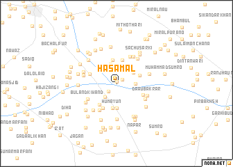
Hāsa Mal (Sind, Pakistan)Hāsa Mal is a town in the Sind region of Pakistan. An overview map of the region around Hāsa Mal is displayed below.
regional and 3d topo map of Hāsa Mal, Pakistan ::
Hāsa Mal airports ::
The nearest airport is SKZ - Sukkur, located 54.8 km south east of Hāsa Mal.
Other airports nearby include SUL - Sui (80.5 km north east), MJD - Moenjodaro (101.0 km south west), RYK - Rahim Yar Khan Sheikh Zayed (170.8 km east), WNS - Nawabshah (216.7 km south), Nearby towns ::
Jangal Katta (0.3km north) //
Nazar Muhammad Katta (1.0km north east) //
Ghulām Haider (1.6km south west) //
Dipe Jo Goith (2.5km north) //
Sālehpur (2.7km south west) //
Yār Muhammad (2.7km east) //
Lāl Katta Goth (3.2km north) //
Jalāl Wāh (3.0km north east) //
Gobind Rām (3.4km north west) //
Muhammad Ākil Unar (3.7km north) //
Pannu Kehr (3.8km north) //
Mullān Wasan Goth (3.5km east) //
Goth Mehr Ali Sadhāla (4.0km south) //
Humāyūn (4.1km south) //
Goth Shaklāni (4.2km south west) //
Dād Muhammad Gorshāni (4.4km south west) //
Ghulām Ali Khān Katta (4.1km west) //
Ābād (4.1km west) //
Bijāwal (4.2km south east) //
Goth Nasīr Khān (4.7km north east) //
Shāhil Sadhāio (5.0km south west) //
Goth Qāim Khān (5.0km north east) //
Ahmad (4.8km south east) //
Buland ki Wānd (4.8km south west) //
Jangu Khān Khosa (5.0km north east) //
Daau Bakrār (4.8km south east) //
Mobel Khān Jatoi (4.8km west) //
Bhai Mohān Das (4.9km east) //
Sachan Uno (5.0km west) //
[all distances 'as the bird flies' and approximate]  Places with similar names to Hāsa Mal, Pakistan ::
Disclaimer :: Information on this page comes without warranty of any kind |
||
|
Where is Hāsa Mal? Elevation and coordinates ::
Latitude (lat): 28°10'10"N Longitude (lon): 68°33'20"E
Elevation (approx.): 61m (map arrows pan, magnifying glasses zoom) |
||
|
Visiting Hāsa Mal? Hotel/Accommodation ::
Book a hotel in Hāsa Mal Travel Guide ::
Buy a travel guide for Pakistan rental cars ::
car rental offers GPS waypoint ::
download a GPX waypoint (PoI) of Hāsa Mal for your GPS receiver
|
||