|
search place name
|
||
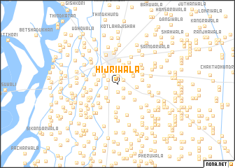
Hījrīwāla (Punjab, Pakistan)Hījrīwāla is a town in the Punjab region of Pakistan. An overview map of the region around Hījrīwāla is displayed below.
regional and 3d topo map of Hījrīwāla, Pakistan ::
Hījrīwāla airports ::
The nearest airport is MUX - Multan Intl, located 91.8 km south east of Hījrīwāla.
Other airports nearby include PZH - Zhob (149.7 km west), Nearby towns ::
Lohārwāla (1.0km north east) //
Basti Muhabba (1.1km south east) //
Nāīwāla (1.2km north) //
Bamb Khiārwāla (1.2km south) //
Jhandīrwāla (1.5km north west) //
Pāolīwāla (1.7km west) //
Rodīwāla (2.3km south) //
Kammewāla (2.2km south east) //
Saidu (2.2km north west) //
Golewāla (2.5km north) //
Lohārwāla (2.6km north) //
Burīwāla (2.5km north east) //
Shaikh Jallu (2.8km north) //
Khāngāh Habib Shāh (2.6km north west) //
Hamīdwāla (2.7km south west) //
Ghānghlewāla (2.8km north east) //
Gudāra Balochān (2.7km east) //
Tarkhānwāla (2.7km west) //
Shekhūwāla (3.1km south west) //
Dūdāwāla (3.2km north) //
Nāīwāla (2.9km west) //
Kotal Qāzi (3.2km south west) //
Hawatwāla (3.7km south) //
Tibba Mirjāna (3.7km north) //
Chunianwāla (3.4km south east) //
Ahmad Yārwāla (3.8km north east) //
Bambalwāla (3.5km north west) //
Jand Khandwāla (3.5km east) //
Mattānwāla (3.8km north east) //
[all distances 'as the bird flies' and approximate] 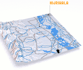 Places with similar names to Hījrīwāla, Pakistan ::
// Hāji Rāwal (PK)
// Hujrewāla (PK)
Disclaimer :: Information on this page comes without warranty of any kind |
||
|
Where is Hījrīwāla? Elevation and coordinates ::
Latitude (lat): 30°55'30"N Longitude (lon): 70°57'0"E
Elevation (approx.): 147m (map arrows pan, magnifying glasses zoom) |
||
|
Visiting Hījrīwāla? Hotel/Accommodation ::
Book a hotel in Hījrīwāla Travel Guide ::
Buy a travel guide for Pakistan rental cars ::
car rental offers GPS waypoint ::
download a GPX waypoint (PoI) of Hījrīwāla for your GPS receiver
|
||