|
search place name
|
||
Islāmpur Farāz (Punjab, Pakistan)Islāmpur Farāz is a town in the Punjab region of Pakistan. An overview map of the region around Islāmpur Farāz is displayed below.
regional and 3d topo map of Islāmpur Farāz, Pakistan ::

Islāmpur Farāz airports ::
The nearest airport is LYP - Faisalabad Intl, located 99.5 km north east of Islāmpur Farāz.
Other airports nearby include MUX - Multan Intl (105.5 km south west), Nearby towns ::
Deti Sīāl (0.0km north) //
Chūriwāla (0.7km north west) //
Wānwāla (1.1km south) //
Fatehpur Piratti (1.6km west) //
Bāhmanwāla (2.1km south west) //
Nekokāra (2.4km south west) //
Islāmpur Nesheb (2.4km north east) //
Daulewāla (2.7km north west) //
Nikkewāla (2.7km west) //
Islāmwāla (3.2km west) //
Jusa (3.7km north) //
Binda Fauja Dhāra (4.0km south east) //
Bula (4.9km south west) //
Kot Rustam (4.9km north east) //
Basti Lāsarūwāla (4.8km north west) //
Basti Islāmpur (4.8km east) //
Hathrādi (5.1km west) //
Aputh Janjiāna (5.1km east) //
Tibba Gahli (5.8km north) //
Pīru (5.8km south) //
Basti Amīr (5.3km west) //
Sāb (5.5km west) //
Basti Havelīwāla (6.1km north west) //
Gādiānwāla (5.6km west) //
Piārewāla (5.7km west) //
Muhammad Rasūl Shāh (5.8km west) //
Basti Rashīd (6.4km north east) //
Allāhyār Jūta (6.4km south east) //
Chāh Darkhānwāla (6.7km north west) //
[all distances 'as the bird flies' and approximate] 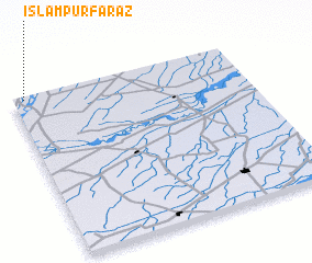 Places with similar names to Islāmpur Farāz, Pakistan :: Disclaimer :: Information on this page comes without warranty of any kind |
||
|
Where is Islāmpur Farāz? Elevation and coordinates ::
Latitude (lat): 30°59'0"N Longitude (lon): 72°3'0"E
Elevation (approx.): 144m (map arrows pan, magnifying glasses zoom) |
||
|
Visiting Islāmpur Farāz? Hotel/Accommodation ::
Book a hotel in Islāmpur Farāz Travel Guide ::
Buy a travel guide for Pakistan rental cars ::
car rental offers GPS waypoint ::
download a GPX waypoint (PoI) of Islāmpur Farāz for your GPS receiver
|
||