|
search place name
|
||
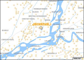
Jakharwāli (Punjab, Pakistan)Jakharwāli is a town in the Punjab region of Pakistan. An overview map of the region around Jakharwāli is displayed below.
regional and 3d topo map of Jakharwāli, Pakistan ::
Jakharwāli airports ::
The nearest airport is MUX - Multan Intl, located 61.5 km south west of Jakharwāli.
Other airports nearby include LYP - Faisalabad Intl (139.3 km north east), Nearby towns ::
Faqīr Siāl (0.9km south east) //
Chadhar (1.0km south west) //
Hodān di Basti (1.5km north west) //
Chāryāri (1.6km north west) //
Basti Jota (2.0km south east) //
Basti Ghulām Qādir (2.2km south east) //
Jander Niāziwāla (2.4km south) //
Wāgha (2.4km west) //
Nāmdār Siāl (2.8km north west) //
Sadqāna Marāli (2.8km north east) //
Basti Ahmad (3.2km north) //
Ahmadwāla (3.4km north west) //
Jander Niāziwāla (3.3km south west) //
Basti Siālān (3.7km south west) //
Teliānwāla (4.2km north) //
Ahmadpur Siāl (4.0km north west) //
Sanpāl (4.0km north east) //
Kot Kāthia (4.2km south) //
Lakhewāla (4.7km north) //
Chadhar (4.0km west) //
Jander Niāziwāla (4.1km west) //
Samundriwāla (4.2km west) //
Ranjītkot (5.2km north) //
Samandwāna (4.6km south west) //
Tibiānwāla (4.6km west) //
Hotwāla (4.7km north west) //
Dhārwiānwāla (4.7km west) //
Basti Mulāzim Hussain (5.3km north) //
Laīwāla (4.7km west) //
[all distances 'as the bird flies' and approximate] 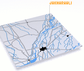 Places with similar names to Jakharwāli, Pakistan :: Disclaimer :: Information on this page comes without warranty of any kind |
||
|
Where is Jakharwāli? Elevation and coordinates ::
Latitude (lat): 30°39'15"N Longitude (lon): 71°47'30"E
Elevation (approx.): 136m (map arrows pan, magnifying glasses zoom) |
||
|
Visiting Jakharwāli? Hotel/Accommodation ::
Book a hotel in Jakharwāli Travel Guide ::
Buy a travel guide for Pakistan rental cars ::
car rental offers GPS waypoint ::
download a GPX waypoint (PoI) of Jakharwāli for your GPS receiver
|
||