|
search place name
|
||
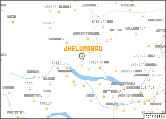
Jhelumābād (Punjab, Pakistan)Jhelumābād is a town in the Punjab region of Pakistan. An overview map of the region around Jhelumābād is displayed below.
regional and 3d topo map of Jhelumābād, Pakistan ::
Jhelumābād airports ::
The nearest airport is MUX - Multan Intl, located 110.1 km south east of Jhelumābād.
Other airports nearby include PZH - Zhob (117.1 km north west), Nearby towns ::
Jhok Bahārwāli (1.3km south) //
Jhok Mir Hamzāwāli (1.7km north) //
Jhok Shūrānīwāli (2.3km north east) //
Jhok Fatehwāli (2.4km south east) //
Jhok Yārewāli (3.3km north) //
Kot Qaisrāni (3.7km south east) //
Kohar (3.7km south west) //
Basti Shīlāni (4.0km north east) //
Jhok Bairandwāli (4.9km north) //
Berānd (4.9km north west) //
Mandwāni (4.9km south west) //
Birota (5.3km south) //
Jhok Shājiwāli (5.9km south) //
Satta (5.2km west) //
Birot Mandwāni (6.0km south) //
Jhok Bilwāniwāli (6.0km south east) //
Soha Phrāgh (5.8km north west) //
Basti Buzdār (6.4km south east) //
Jhok Buknewāli (6.3km north east) //
Chāh Sher Bahādur (6.8km east) //
Jhok Naulewāli (7.0km south east) //
Jhok Jarwārwāli (7.2km north east) //
Basti Jarwār (8.4km north east) //
Buzmār (8.4km south west) //
Thattha (8.5km north east) //
Gharpewāli Jhok (9.2km south east) //
Gohand (9.6km north west) //
Wattewāla (10.2km south east) //
Roda (10.6km south west) //
[all distances 'as the bird flies' and approximate] 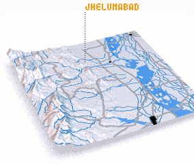 Places with similar names to Jhelumābād, Pakistan :: Disclaimer :: Information on this page comes without warranty of any kind |
||
|
Where is Jhelumābād? Elevation and coordinates ::
Latitude (lat): 30°49'0"N Longitude (lon): 70°31'0"E
Elevation (approx.): 215m (map arrows pan, magnifying glasses zoom) |
||
|
Visiting Jhelumābād? Hotel/Accommodation ::
Book a hotel in Jhelumābād Travel Guide ::
Buy a travel guide for Pakistan rental cars ::
car rental offers GPS waypoint ::
download a GPX waypoint (PoI) of Jhelumābād for your GPS receiver
|
||