|
search place name
|
||
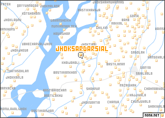
Jhok Sardār Siāl (Punjab, Pakistan)Jhok Sardār Siāl is a town in the Punjab region of Pakistan. An overview map of the region around Jhok Sardār Siāl is displayed below.
regional and 3d topo map of Jhok Sardār Siāl, Pakistan ::
Jhok Sardār Siāl airports ::
The nearest airport is PZH - Zhob, located 145.6 km west of Jhok Sardār Siāl.
Other airports nearby include MUX - Multan Intl (165.8 km south), Nearby towns ::
Basti Bāli (0.6km south) //
Jhok Ghāro (0.8km north east) //
Basti Vaisānwāli (1.0km east) //
Gujja Shimāli (1.2km south) //
Girah Rāwān (1.8km north) //
Basti Phato Siāl (1.6km east) //
Jhok Fāzal Khān (2.1km south east) //
Gujja Janūbi (2.7km south) //
Jhok Ditta (2.4km north east) //
Jhok Tibbi (2.7km north east) //
Dharangi (3.1km south) //
Jhok Sola (2.7km east) //
Khai Jamāli (2.9km south west) //
Basti Saiyidān (3.4km east) //
Basti Arāin (4.3km north east) //
Jhok Buchhri (3.9km west) //
Hussainābād (4.1km south east) //
Chāh Ārāiānwāla (4.4km south east) //
Dhapwāli (4.1km west) //
Binda Bāhu Shāh (4.9km south) //
Niwāni (4.9km south east) //
Chāh Siāl Kalān (4.7km east) //
Basti Miān Khān (5.2km south west) //
Jhamat (5.4km south) //
Wadhowāli (4.9km east) //
Kaneri (5.5km north east) //
Jhok Qādar (5.8km north) //
Hadir Shāh (6.0km south) //
Gorchcha (5.5km north east) //
[all distances 'as the bird flies' and approximate]  Places with similar names to Jhok Sardār Siāl, Pakistan :: Disclaimer :: Information on this page comes without warranty of any kind |
||
|
Where is Jhok Sardār Siāl? Elevation and coordinates ::
Latitude (lat): 31°38'41"N Longitude (lon): 70°57'33"E
Elevation (approx.): 166m (map arrows pan, magnifying glasses zoom) |
||
|
Visiting Jhok Sardār Siāl? Hotel/Accommodation ::
Book a hotel in Jhok Sardār Siāl Travel Guide ::
Buy a travel guide for Pakistan rental cars ::
car rental offers GPS waypoint ::
download a GPX waypoint (PoI) of Jhok Sardār Siāl for your GPS receiver
|
||