|
search place name
|
||
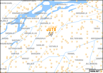
Jūta (Punjab, Pakistan)Jūta is a town in the Punjab region of Pakistan. An overview map of the region around Jūta is displayed below.
regional and 3d topo map of Jūta, Pakistan ::
Jūta airports ::
The nearest airport is MUX - Multan Intl, located 43.3 km south west of Jūta.
Other airports nearby include LYP - Faisalabad Intl (155.2 km north east), Nearby towns ::
Jūta (0.5km north east) //
Khānqāh Shāh Khaliq (1.0km south east) //
Thakrālān (1.1km west) //
Khatti Chor (1.6km west) //
Chitaurgarh (1.9km south) //
Jamālpur (1.6km east) //
Jalālwāla (2.1km north) //
Khān Beg (2.0km north east) //
Chak Bandi (2.4km south west) //
Mamdāl (3.7km north) //
Ahmadpur (3.2km east) //
Khān Bahādurgarh (4.0km south west) //
Aujla (3.7km south east) //
Bahādurwāla (3.7km south east) //
Jandīr (4.0km north east) //
Azīmwāla (3.7km east) //
Ghauspur (3.8km south west) //
Chūnīwāla (4.1km north west) //
Rachhīwāla (3.9km north west) //
Chauki Nedul (4.2km north east) //
Āsīpur (4.8km south) //
Kotwāla (4.9km south) //
Qādir Bakhshwāla (5.0km north) //
Khān Chandwāla (4.9km south) //
Berwāla (4.6km north west) //
Basti Traggar (4.6km north west) //
Khuda Bakhsk Minor (4.6km north west) //
Ahār Bela (4.9km north west) //
Shergarh (4.9km south east) //
[all distances 'as the bird flies' and approximate] 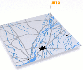 Places with similar names to Jūta, Pakistan ::
Disclaimer :: Information on this page comes without warranty of any kind |
||
|
Where is Jūta? Elevation and coordinates ::
Latitude (lat): 30°29'0"N Longitude (lon): 71°44'0"E
Elevation (approx.): 133m (map arrows pan, magnifying glasses zoom) |
||
|
Visiting Jūta? Hotel/Accommodation ::
Book a hotel in Jūta Travel Guide ::
Buy a travel guide for Pakistan rental cars ::
car rental offers GPS waypoint ::
download a GPX waypoint (PoI) of Jūta for your GPS receiver
|
||