|
search place name
|
||
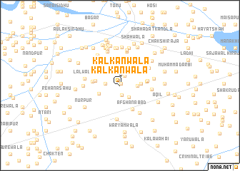
Kālkānwāla (Punjab, Pakistan)Kālkānwāla is a town in the Punjab region of Pakistan. An overview map of the region around Kālkānwāla is displayed below.
regional and 3d topo map of Kālkānwāla, Pakistan ::
Kālkānwāla airports ::
The nearest airport is MUX - Multan Intl, located 69.2 km south west of Kālkānwāla.
Other airports nearby include LYP - Faisalabad Intl (131.7 km north east), Nearby towns ::
Wīrrānwāla (0.3km north east) //
Kālkānwāla (1.4km north) //
Kot Abdullāh (1.6km south) //
Pahlwānwāla (1.7km north east) //
Budhu Mahāni da Khu (1.9km north) //
Fazilwāla (2.2km north east) //
Muhammadpur (2.2km south east) //
Kālkānwāla Bhir (2.0km west) //
Husainābād (2.4km east) //
Nihālewāla (2.9km north west) //
Nūnwāla (2.8km east) //
Roshanwāla (3.3km north) //
Jahānpur (3.1km south west) //
Ali Gohārwāla (3.7km north) //
Gobindgarh (3.5km north east) //
Chirāgh Shāhwāla (3.4km west) //
Bashīrwāla (3.8km north west) //
Afghānābād (4.1km south east) //
Kīkarwāla (3.6km east) //
Allāhhu (4.2km north) //
Jummewāla (3.8km west) //
Wīriānwāla (3.8km east) //
Labbuwāla (4.2km north west) //
Chhīnīwāla (4.3km north east) //
Atāpur (4.3km east) //
Umedgarh (4.9km north east) //
Tahsīldārwāla (4.8km north east) //
Makhdūmpur (5.3km south) //
Murtazāpur (5.1km south east) //
[all distances 'as the bird flies' and approximate] 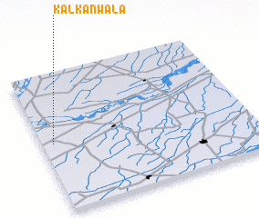 Places with similar names to Kālkānwāla, Pakistan ::
// Kolakanaweli (LK)
// Kālkānwāla (PK)
Disclaimer :: Information on this page comes without warranty of any kind |
||
|
Where is Kālkānwāla? Elevation and coordinates ::
Latitude (lat): 30°29'50"N Longitude (lon): 72°3'15"E
Elevation (approx.): 137m (map arrows pan, magnifying glasses zoom) |
||
|
Visiting Kālkānwāla? Hotel/Accommodation ::
Book a hotel in Kālkānwāla Travel Guide ::
Buy a travel guide for Pakistan rental cars ::
car rental offers GPS waypoint ::
download a GPX waypoint (PoI) of Kālkānwāla for your GPS receiver
|
||