|
search place name
|
||
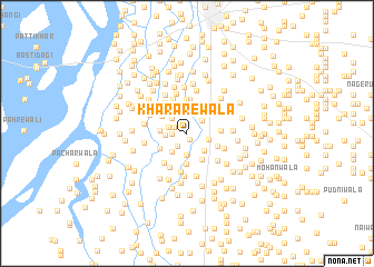
Khararewāla (Punjab, Pakistan)Khararewāla is a town in the Punjab region of Pakistan. An overview map of the region around Khararewāla is displayed below.
regional and 3d topo map of Khararewāla, Pakistan ::
Khararewāla airports ::
The nearest airport is MUX - Multan Intl, located 86.7 km south east of Khararewāla.
Other airports nearby include PZH - Zhob (149.5 km west), Nearby towns ::
Dakkewala (0.7km south east) //
Boperāwāla (1.2km north west) //
Khandwala (1.3km west) //
Doli (1.5km south west) //
Bhattīwāla (1.7km west) //
Dhīngānewāla (1.8km north east) //
Billu (2.2km south) //
Sher Muhammadwāla (1.9km west) //
Walīdādwāla (2.0km north west) //
Bighewala (2.0km east) //
Tibbewāla (2.2km south east) //
Ratta (2.3km south west) //
Kalyewāla (2.4km west) //
Rāmsar (2.8km north) //
Mochiwāla (2.7km north west) //
Gopāngwāla (3.0km north) //
Tibba Charhoyān (2.9km south east) //
Jandānwāla (3.1km south) //
Basti Sābiqwāli (2.8km south west) //
Bāsūwāla (2.9km south east) //
Jaman Shāh (3.4km north) //
Budhewāla (3.4km north) //
Bāghonwāla (2.9km east) //
Dājal (3.6km north) //
Nargāna (3.5km south west) //
Jālīwāla (3.6km north west) //
Dādwāla (3.7km south west) //
Charhoewāla (3.9km south) //
Bahādurwāla (3.5km south east) //
[all distances 'as the bird flies' and approximate] 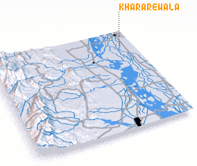 Places with similar names to Khararewāla, Pakistan ::
Disclaimer :: Information on this page comes without warranty of any kind |
||
|
Where is Khararewāla? Elevation and coordinates ::
Latitude (lat): 30°51'10"N Longitude (lon): 70°55'0"E
Elevation (approx.): 142m (map arrows pan, magnifying glasses zoom) |
||
|
Visiting Khararewāla? Hotel/Accommodation ::
Book a hotel in Khararewāla Travel Guide ::
Buy a travel guide for Pakistan rental cars ::
car rental offers GPS waypoint ::
download a GPX waypoint (PoI) of Khararewāla for your GPS receiver
|
||