|
search place name
|
||
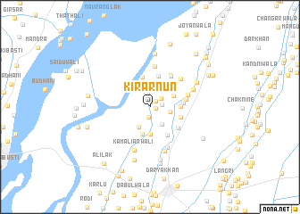
Kirār Nūn (Punjab, Pakistan)Kirār Nūn is a town in the Punjab region of Pakistan. An overview map of the region around Kirār Nūn is displayed below.
regional and 3d topo map of Kirār Nūn, Pakistan ::
Kirār Nūn airports ::
The nearest airport is PZH - Zhob, located 164.3 km west of Kirār Nūn.
Other airports nearby include MUX - Multan Intl (188.7 km south), LYP - Faisalabad Intl (190.0 km east), Nearby towns ::
Balochānwāli (0.6km north) //
Joyanwāli (0.7km east) //
Sohānra Nūn (1.0km north east) //
Bhaun Sharqi (1.2km south) //
Thaliah Nūn (1.3km east) //
Basti Nayānwāli (1.7km north) //
Budha Nūn (1.6km north east) //
Zama (2.2km east) //
Sukha Shāh (2.5km south east) //
Bhayn Gharbi (2.7km south west) //
Nādir Shāhwāla (2.8km north east) //
Shaikh Chisti (3.1km north) //
Bhankhu (2.9km north east) //
Dabbewāli (3.2km north) //
Lundi (3.4km south) //
Kharāi (3.5km south) //
Kaniāl (3.8km north) //
Darkhānan (3.6km north east) //
Tibba Dharyānwāla (3.3km east) //
Joyānwāla (4.0km north) //
Ahmad Sandhi (3.5km east) //
Jhok Bhonānwāli (4.0km south east) //
Quraishi (3.6km east) //
Hasan Shāh (4.0km south east) //
Dabbewāli (3.9km east) //
Qalandar Bakhsh (4.5km north east) //
Jhok Mehr Shāh (4.6km north east) //
Bhandānwāli (4.3km east) //
Basti Lāl Shāh (5.1km north) //
[all distances 'as the bird flies' and approximate] 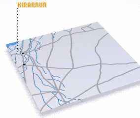 Places with similar names to Kirār Nūn, Pakistan :: Disclaimer :: Information on this page comes without warranty of any kind |
||
|
Where is Kirār Nūn? Elevation and coordinates ::
Latitude (lat): 31°52'50"N Longitude (lon): 71°5'5"E
Elevation (approx.): 172m (map arrows pan, magnifying glasses zoom) |
||
|
Visiting Kirār Nūn? Hotel/Accommodation ::
Book a hotel in Kirār Nūn Travel Guide ::
Buy a travel guide for Pakistan rental cars ::
car rental offers GPS waypoint ::
download a GPX waypoint (PoI) of Kirār Nūn for your GPS receiver
|
||