|
search place name
|
||
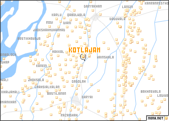
Kotla Jām (Punjab, Pakistan)Kotla Jām is a town in the Punjab region of Pakistan. An overview map of the region around Kotla Jām is displayed below.
regional and 3d topo map of Kotla Jām, Pakistan ::
Kotla Jām airports ::
The nearest airport is PZH - Zhob, located 158.4 km west of Kotla Jām.
Other airports nearby include MUX - Multan Intl (169.0 km south), LYP - Faisalabad Intl (185.3 km east), Nearby towns ::
Lehīwāla (1.2km north) //
Basti Aulakh (1.3km south west) //
Baddewāla (1.3km north west) //
Basti Khokharān (1.3km north east) //
Rasīdwāla (1.4km north east) //
Baggāh (1.6km west) //
Thārewāla (1.8km north west) //
Chāh Machandīwāla (1.8km south west) //
Basti Habīb Shāh (2.1km north east) //
Mochīwāla (2.1km north west) //
Chuni Shimāli (2.1km south west) //
Machhīwāla (2.2km north) //
Chāh Miānwāla (2.4km north) //
Chāh Haidarūwāla (2.4km north west) //
Chāh Bilāndewāla (2.4km south west) //
Basti Khokhrān (2.7km north east) //
Mangriānwāla (2.9km north) //
Tarkhānānwāla (2.9km south west) //
Bāghri (2.6km west) //
Awanānwāla (3.2km north) //
Chāh Khamīsewāla (3.3km north) //
Goria (3.3km north west) //
Maikwāla (3.7km north) //
Balochwāla (3.7km south) //
Chāh Nolānwāla (3.3km north west) //
Hassu Shāhwāla (3.8km south) //
Balhewāla (3.6km west) //
Tarkhānewāla (3.7km west) //
Nāianwāla (3.9km south west) //
[all distances 'as the bird flies' and approximate] 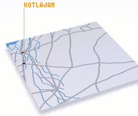 Places with similar names to Kotla Jām, Pakistan :: Disclaimer :: Information on this page comes without warranty of any kind |
||
|
Where is Kotla Jām? Elevation and coordinates ::
Latitude (lat): 31°42'0"N Longitude (lon): 71°5'0"E
Elevation (approx.): 170m (map arrows pan, magnifying glasses zoom) |
||
|
Visiting Kotla Jām? Hotel/Accommodation ::
Book a hotel in Kotla Jām Travel Guide ::
Buy a travel guide for Pakistan rental cars ::
car rental offers GPS waypoint ::
download a GPX waypoint (PoI) of Kotla Jām for your GPS receiver
|
||