|
search place name
|
||
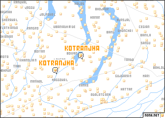
Kot Rānjha (Punjab, Pakistan)Kot Rānjha is a town in the Punjab region of Pakistan. An overview map of the region around Kot Rānjha is displayed below.
regional and 3d topo map of Kot Rānjha, Pakistan ::
Kot Rānjha airports ::
The nearest airport is IXJ - Jammu, located 53.3 km east of Kot Rānjha.
Other airports nearby include ATQ - Amritsar (121.7 km south east), LHE - Lahore Allama Iqbal Intl (132.5 km south), RAZ - Rawala Kot Rawalakot (133.7 km north), IXP - Pathankot (138.8 km east), Nearby towns ::
Jhammat (0.3km south east) //
Dudrai (1.4km north east) //
Chak Kamāl (1.5km east) //
Jhammat (1.7km south west) //
Gondal (1.8km east) //
Boivān (1.8km west) //
Boryā (1.9km west) //
Jindar (2.2km north) //
Ioda (2.0km west) //
Tibbi (2.2km south west) //
Jasso Sarāi (2.6km north east) //
Darya (2.6km north east) //
Kotli (2.7km south west) //
Kotla Kohāta (2.8km south west) //
Chak Mīrān (3.1km north east) //
Mālowāl (3.6km north) //
Bājo (3.5km north east) //
Shaikh Alike (3.6km south east) //
Rehan (3.5km south east) //
Kasāb (3.2km east) //
Pamrah (3.9km north west) //
Pejoke (4.3km south) //
Kariānwāla (4.5km north) //
Hājīwāla (4.2km north west) //
Bharāj (4.4km south west) //
Lakhanwāl Khās (4.9km south) //
Kot Mrhru (4.2km east) //
Lāhsar (4.3km west) //
Hakīmpur (5.2km south) //
[all distances 'as the bird flies' and approximate] 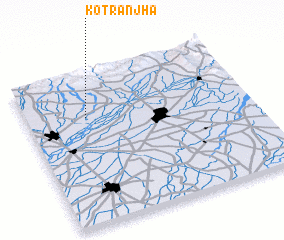 Places with similar names to Kot Rānjha, Pakistan ::
// Kot Rānjha (PK)
Disclaimer :: Information on this page comes without warranty of any kind |
||
|
Where is Kot Rānjha? Elevation and coordinates ::
Latitude (lat): 32°42'40"N Longitude (lon): 74°16'10"E
Elevation (approx.): 265m (map arrows pan, magnifying glasses zoom) |
||
|
Visiting Kot Rānjha? Hotel/Accommodation ::
Book a hotel in Kot Rānjha Travel Guide ::
Buy a travel guide for Pakistan rental cars ::
car rental offers GPS waypoint ::
download a GPX waypoint (PoI) of Kot Rānjha for your GPS receiver
|
||