|
search place name
|
||
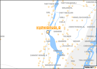
Kurhiānwāla (Punjab, Pakistan)Kurhiānwāla is a town in the Punjab region of Pakistan. An overview map of the region around Kurhiānwāla is displayed below.
regional and 3d topo map of Kurhiānwāla, Pakistan ::
Kurhiānwāla airports ::
The nearest airport is LYP - Faisalabad Intl, located 86.7 km east of Kurhiānwāla.
Other airports nearby include MUX - Multan Intl (142.2 km south west), Nearby towns ::
Loha Bhīr (1.9km north) //
Jhok (1.9km north) //
Jhākhi (1.9km south) //
Ziārat Muhammad Husain Shāh (1.9km south west) //
Chāh Faqīrwāla (2.1km west) //
Gājiābād (3.1km south west) //
Kot Langar (3.7km north) //
Māchhīwāl (3.7km north) //
Chhohan (3.7km south) //
Turk (3.7km south) //
Ghughiāna (3.2km east) //
Shāhana (3.2km east) //
Thatta Kanhaiya Lāl (4.0km north) //
Bindi Amīr Shāh (3.8km south east) //
Bela Kandrāna (3.9km north east) //
Mullāniwāla (4.6km south) //
Ahmadpur (4.6km north) //
Umrāna (4.6km north) //
Bandāwāla (5.0km south) //
Nijābat (4.7km east) //
Kot Sukha (4.7km east) //
Saliāna (4.7km east) //
Sai Sarwar (4.7km east) //
Garhi Fateh Ullah (5.6km south) //
Sheroāna (5.8km south) //
Māchhiāna (5.8km north) //
Khutiāna (5.1km east) //
Kot Sāhib (5.1km east) //
Chāh Raniwāla (5.9km south) //
[all distances 'as the bird flies' and approximate] 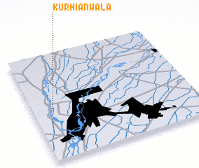 Places with similar names to Kurhiānwāla, Pakistan :: Disclaimer :: Information on this page comes without warranty of any kind |
||
|
Where is Kurhiānwāla? Elevation and coordinates ::
Latitude (lat): 31°21'0"N Longitude (lon): 72°5'0"E
Elevation (approx.): 156m (map arrows pan, magnifying glasses zoom) |
||
|
Visiting Kurhiānwāla? Hotel/Accommodation ::
Book a hotel in Kurhiānwāla Travel Guide ::
Buy a travel guide for Pakistan rental cars ::
car rental offers GPS waypoint ::
download a GPX waypoint (PoI) of Kurhiānwāla for your GPS receiver
|
||