|
search place name
|
||
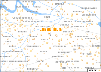
Labbuwāla (Punjab, Pakistan)Labbuwāla is a town in the Punjab region of Pakistan. An overview map of the region around Labbuwāla is displayed below.
regional and 3d topo map of Labbuwāla, Pakistan ::
Labbuwāla airports ::
The nearest airport is MUX - Multan Intl, located 68.5 km south west of Labbuwāla.
Other airports nearby include LYP - Faisalabad Intl (131.2 km north east), Nearby towns ::
Bashīrwāla (0.8km south) //
Puniānwāla (1.2km north west) //
Nihālewāla (1.3km south east) //
Jallewāla (1.6km north) //
Ali Gohārwāla (1.8km east) //
Jandwāla (2.2km north east) //
Roshanwāla (2.0km east) //
Chirāgh Shāhwāla (2.6km south) //
Kīkarwāla (2.6km north) //
Hatāra (2.7km north) //
Husainābād (2.8km north) //
Jummewāla (2.8km south) //
Karāri (2.9km north) //
Kālkānwāla Bhir (3.0km south) //
Chak Hatāra (3.0km north) //
Khajjiwāla (3.1km north) //
Lālwāla (3.0km south west) //
Bakhshīwāla (3.2km north east) //
Jārhwāla (2.9km west) //
Hātimwāla (3.3km north east) //
Sultān Mahmūd de Basti (3.3km north west) //
Budhu Mahāni da Khu (3.2km south east) //
Alāwalwāla (3.7km north) //
Kot Mulāna (3.5km north east) //
Kālkānwāla (3.4km south east) //
Jhalār Kotwāli (3.6km north west) //
Naya Alāwalwāla (3.9km north) //
Ratti Tehri Bhir (4.0km south west) //
Pahlwānwāla (3.7km south east) //
[all distances 'as the bird flies' and approximate] 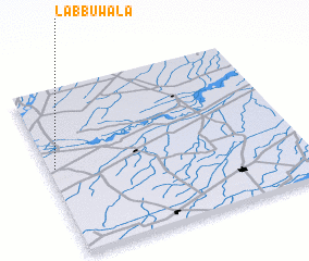 Places with similar names to Labbuwāla, Pakistan ::
Disclaimer :: Information on this page comes without warranty of any kind |
||
|
Where is Labbuwāla? Elevation and coordinates ::
Latitude (lat): 30°31'35"N Longitude (lon): 72°1'35"E
Elevation (approx.): 137m (map arrows pan, magnifying glasses zoom) |
||
|
Visiting Labbuwāla? Hotel/Accommodation ::
Book a hotel in Labbuwāla Travel Guide ::
Buy a travel guide for Pakistan rental cars ::
car rental offers GPS waypoint ::
download a GPX waypoint (PoI) of Labbuwāla for your GPS receiver
|
||