|
search place name
|
||
Logīwāla (Punjab, Pakistan)Logīwāla is a town in the Punjab region of Pakistan. An overview map of the region around Logīwāla is displayed below.
regional and 3d topo map of Logīwāla, Pakistan ::

Logīwāla airports ::
The nearest airport is LYP - Faisalabad Intl, located 20.5 km east of Logīwāla.
Other airports nearby include LHE - Lahore Allama Iqbal Intl (154.6 km east), MUX - Multan Intl (186.0 km south west), Nearby towns ::
Gajiāni (2.3km south west) //
Bhojuāni (2.6km north west) //
Nasrāna (2.6km north east) //
Māla Gondiān (3.0km east) //
Balluāna Kalān (3.2km west) //
Dhuni Deo (3.9km south west) //
Tutwāli (4.2km north) //
Neliānwāla (4.2km north) //
Arniānwāla (4.2km north) //
Subedārwāla (5.1km south) //
Sarhāla Kalān (4.8km south east) //
Vakīlwāla (5.4km south) //
Tuarwāli (5.1km north east) //
Dandiwāl (5.6km south) //
Dodi Gulābipur (5.0km east) //
Chauntra Sargāna (5.2km north west) //
Nūrewāla (5.2km north west) //
Maduāna (5.9km north) //
Gilotrānwāli (5.9km north) //
Kot Muhammad Khān (6.2km south) //
Narulla (6.5km south) //
Pasiānwāla (6.3km south west) //
Painsera Bahbalpur (6.3km south east) //
Mazaria Dhingriān (6.1km north east) //
Nāmewāla (6.5km north west) //
Tahsīldārwāla (6.9km south) //
Satiāna (6.3km east) //
Kot Rām Chand (7.4km south) //
Jhok Kalyār (7.6km north) //
[all distances 'as the bird flies' and approximate] 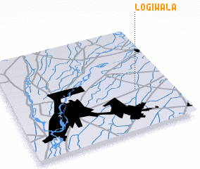 Places with similar names to Logīwāla, Pakistan :: Disclaimer :: Information on this page comes without warranty of any kind |
||
|
Where is Logīwāla? Elevation and coordinates ::
Latitude (lat): 31°23'55"N Longitude (lon): 72°47'0"E
Elevation (approx.): 179m (map arrows pan, magnifying glasses zoom) |
||
|
Visiting Logīwāla? Hotel/Accommodation ::
Book a hotel in Logīwāla Travel Guide ::
Buy a travel guide for Pakistan rental cars ::
car rental offers GPS waypoint ::
download a GPX waypoint (PoI) of Logīwāla for your GPS receiver
|
||