|
search place name
|
||
Lunihār (Sind, Pakistan)Lunihār is a town in the Sind region of Pakistan. An overview map of the region around Lunihār is displayed below.
regional and 3d topo map of Lunihār, Pakistan ::

Lunihār airports ::
The nearest airport is BDN - Talhar, located 93.8 km west of Lunihār.
Other airports nearby include BHJ - Bhuj (171.5 km south), IXY - Kandla (193.6 km south), WNS - Nawabshah (206.7 km north west), Nearby towns ::
Goki (2.9km south) //
Āsu (3.1km south) //
Tiyyab Nahori (4.0km north west) //
Phangārio (4.7km south) //
Phangāria (5.3km south) //
Desar ji Wand (5.9km north) //
Khāro Dangro (5.7km north west) //
Sāyānsar (6.8km south west) //
Narān jo Khārio (6.8km east) //
Saghror Tarāi (7.0km west) //
Lalyāri (7.7km north west) //
Āmrio (7.7km north west) //
Drābi (8.6km south) //
Jakario (8.7km south east) //
Iban jo Tar (9.6km north west) //
Sar (10.2km south west) //
Gajri (11.5km north west) //
[all distances 'as the bird flies' and approximate] 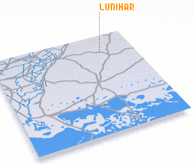
Disclaimer :: Information on this page comes without warranty of any kind |
||
|
Where is Lunihār? Elevation and coordinates ::
Latitude (lat): 24°50'0"N Longitude (lon): 69°46'0"E
Elevation (approx.): 62m (map arrows pan, magnifying glasses zoom) |
||
|
Visiting Lunihār? Hotel/Accommodation ::
Book a hotel in Lunihār Travel Guide ::
Buy a travel guide for Pakistan rental cars ::
car rental offers GPS waypoint ::
download a GPX waypoint (PoI) of Lunihār for your GPS receiver
|
||