|
search place name
|
||
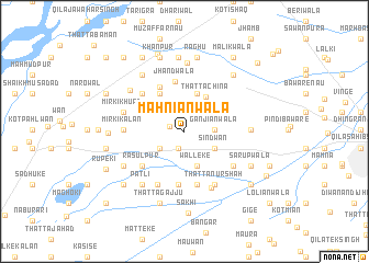
Mahniānwāla (Punjab, Pakistan)Mahniānwāla is a town in the Punjab region of Pakistan. An overview map of the region around Mahniānwāla is displayed below.
regional and 3d topo map of Mahniānwāla, Pakistan ::
Mahniānwāla airports ::
The nearest airport is LYP - Faisalabad Intl, located 93.1 km south west of Mahniānwāla.
Other airports nearby include LHE - Lahore Allama Iqbal Intl (105.3 km south east), ATQ - Amritsar (129.0 km east), IXJ - Jammu (142.3 km north east), ISB - Islamabad Chaklala (174.4 km north), Nearby towns ::
Bhopa (1.4km west) //
Fatehpur (1.8km south) //
Bālo Kuhna (2.3km north east) //
Naurozpur (2.7km south west) //
Nawānshahr Muhājidān (2.7km south west) //
Ganjiānwāla (2.6km east) //
Chhanni Jāna (2.9km north west) //
Thatta Jahid Hasanwāla (3.1km south east) //
Sindwān (3.1km south east) //
Bālo Nau (3.3km north east) //
Walleke (3.7km south) //
Chiniot (3.4km north west) //
Kot Saiyid Muhammad (4.0km north) //
Thatta Chīna (4.0km north east) //
Rachand (4.4km north west) //
Saiyidānwāla (4.9km north west) //
Jhandwāla (5.2km north) //
Husseke (5.4km south) //
Shāhāna (5.5km south) //
Pīr Kamāl (5.5km south) //
Rasūlpur (5.1km south west) //
Rām Tarār (5.3km north west) //
Khude (5.9km south west) //
Phullo Chirāg Shāh (5.5km south east) //
Bimiānwāla (5.5km south east) //
Mīrki Kalān (5.2km west) //
Thatta Nūr Shāh (6.0km south east) //
Chāhpipri (6.2km south) //
Mīrki Khurd (5.6km west) //
[all distances 'as the bird flies' and approximate]  Places with similar names to Mahniānwāla, Pakistan ::
// Manānwāla (PK)
// Mānānwāla (PK)
// Miānānwāla (PK)
// Miāniānwāli (PK)
// Monānwāla (PK)
// Muniānwāla (PK)
// Muniānwāla (PK)
// Muniānwāla (PK)
// Muniānwāla (PK)
// Muniānwāla (PK)
Disclaimer :: Information on this page comes without warranty of any kind |
||
|
Where is Mahniānwāla? Elevation and coordinates ::
Latitude (lat): 32°4'55"N Longitude (lon): 73°30'20"E
Elevation (approx.): 204m (map arrows pan, magnifying glasses zoom) |
||
|
Visiting Mahniānwāla? Hotel/Accommodation ::
Book a hotel in Mahniānwāla Travel Guide ::
Buy a travel guide for Pakistan rental cars ::
car rental offers GPS waypoint ::
download a GPX waypoint (PoI) of Mahniānwāla for your GPS receiver
|
||