|
search place name
|
||
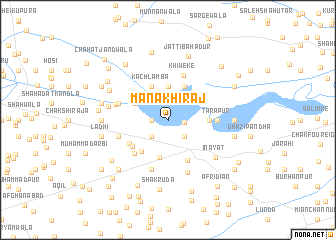
Mānak Hirāj (Punjab, Pakistan)Mānak Hirāj is a town in the Punjab region of Pakistan. An overview map of the region around Mānak Hirāj is displayed below.
regional and 3d topo map of Mānak Hirāj, Pakistan ::
Mānak Hirāj airports ::
The nearest airport is MUX - Multan Intl, located 85.8 km south west of Mānak Hirāj.
Other airports nearby include LYP - Faisalabad Intl (117.0 km north east), Nearby towns ::
Ghauspur (1.6km west) //
Magha Hirāj (1.6km east) //
Talamba (2.4km south east) //
Sajāwal Hirāj (2.4km south west) //
Māi Sapūrān (3.7km north) //
Jatti Abdāl (4.0km north east) //
Kachlamba (4.0km north west) //
Hayāt Shāh (3.7km north west) //
Dalwāla (4.2km south) //
Nawāzābād (4.4km south west) //
Dāduāna (4.0km east) //
Kotiewāla (4.5km south west) //
Bhingān (4.9km south east) //
Daulatewāla (4.6km south west) //
Khīweke (5.2km north) //
Jangal Derewāla Shumāli (4.9km south west) //
Tārāpur (4.8km east) //
Rautla (4.8km east) //
Husainpur Āriwāla (5.8km south) //
Nūri Sohāg (5.8km south) //
Josa (5.1km west) //
Baghdād (5.1km west) //
Bhūsi Pindi (5.1km west) //
Baghdād Kothiwāla (5.3km west) //
Guru Gobindpur (6.2km south) //
Ināyat (6.2km south east) //
Pīr Gul Muhammad (5.9km west) //
Bhūreke (6.5km north west) //
Bela Panjuāna (6.4km east) //
[all distances 'as the bird flies' and approximate]  Places with similar names to Mānak Hirāj, Pakistan ::
// Mānak Hirāj (PK)
Disclaimer :: Information on this page comes without warranty of any kind |
||
|
Where is Mānak Hirāj? Elevation and coordinates ::
Latitude (lat): 30°33'0"N Longitude (lon): 72°13'0"E
Elevation (approx.): 143m (map arrows pan, magnifying glasses zoom) |
||
|
Visiting Mānak Hirāj? Hotel/Accommodation ::
Book a hotel in Mānak Hirāj Travel Guide ::
Buy a travel guide for Pakistan rental cars ::
car rental offers GPS waypoint ::
download a GPX waypoint (PoI) of Mānak Hirāj for your GPS receiver
|
||