|
search place name
|
||
Mandwani (Punjab, Pakistan)Mandwani is a town in the Punjab region of Pakistan. An overview map of the region around Mandwani is displayed below.
regional and 3d topo map of Mandwani, Pakistan ::

Mandwani airports ::
The nearest airport is PZH - Zhob, located 144.3 km north of Mandwani.
Other airports nearby include MUX - Multan Intl (158.1 km east), SUL - Sui (170.2 km south), RYK - Rahim Yar Khan Sheikh Zayed (194.7 km south), Nearby towns ::
Takh (2.6km south) //
Marofāni (2.7km south east) //
Lanjāni (3.0km east) //
Kunal (3.2km west) //
Kodi (4.7km south) //
Lanjāni (4.4km south east) //
Hāji Lanjāni (4.5km south east) //
Wazīr Khān (4.8km west) //
Taghāo (5.5km north) //
Lanjāni (5.5km south east) //
Nathu Rāhmāni (5.2km west) //
Dādwāni (5.9km south) //
Nasīr Khān (5.6km west) //
Wahāb ka Haweli (5.8km west) //
Fauj Ali Rind (6.7km south west) //
Jant Ali (7.2km west) //
Sarāti (8.3km south) //
Nilra (7.9km west) //
Ismāil Khān (8.5km north west) //
Miran Rabāni (8.6km north west) //
Khiddar Dādwāni (8.9km north west) //
Karam Khān (9.3km north west) //
Mahmud Jamalāni (9.5km north west) //
Nūr Khān Jamalāni (9.8km north west) //
Chhajra (10.0km south west) //
[all distances 'as the bird flies' and approximate] 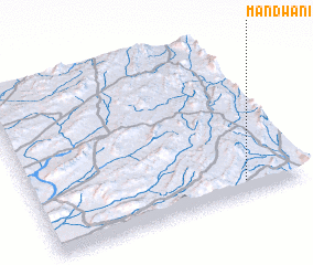 Places with similar names to Mandwani, Pakistan ::
// Mendwana (ZA)
// Monotwane (ZA)
// Monotwane (ZA)
// Muntwana (BI)
// Muntaiwani (ID)
// Manduwani (ZM)
// Mbindawina (ZM)
// Mandwāni (PK)
Disclaimer :: Information on this page comes without warranty of any kind |
||
|
Where is Mandwani? Elevation and coordinates ::
Latitude (lat): 30°5'10"N Longitude (lon): 69°47'0"E
Elevation (approx.): 1273m (map arrows pan, magnifying glasses zoom) |
||
|
Visiting Mandwani? Hotel/Accommodation ::
Book a hotel in Mandwani Travel Guide ::
Buy a travel guide for Pakistan rental cars ::
car rental offers GPS waypoint ::
download a GPX waypoint (PoI) of Mandwani for your GPS receiver
|
||