|
search place name
|
||
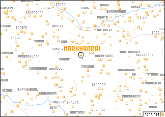
Markhānrai (Federally Administered Tribal Areas, Pakistan)Markhānrai is a town in the Federally Administered Tribal Areas region of Pakistan. An overview map of the region around Markhānrai is displayed below.
regional and 3d topo map of Markhānrai, Pakistan ::
Markhānrai airports ::
The nearest airport is PEW - Peshawar Intl, located 75.1 km south of Markhānrai.
Other airports nearby include SDT - Saidu Sharif (81.2 km east), JAA - Jalalabad (95.2 km west), ISB - Islamabad Chaklala (189.4 km south east), Nearby towns ::
Dingān (1.6km north) //
Khro Shāh (2.1km north) //
Top (2.0km north east) //
Mena (2.2km north east) //
Mānrai (2.5km north west) //
Lala Khān Shāh (2.6km north) //
Zullam Kot (2.6km north east) //
Pāi Khān (2.9km south) //
Surdago (3.0km north) //
Naukhār (3.3km north) //
Bāto Mena (3.0km south east) //
Kasaba (3.8km north) //
Dheri (3.2km east) //
Daural (3.8km north) //
Ghwaghasai (3.9km north) //
Shaikhān (4.0km south) //
Rambat (3.4km west) //
Khwāga (4.1km south) //
Nari Shāh (3.9km north west) //
Manro (3.6km east) //
Zar Mandai (4.2km north west) //
Tola (4.4km north) //
Mānūgai (4.1km north east) //
Shamshak (4.8km north) //
Khazāna (4.7km north west) //
Tsapparai (4.2km south east) //
Jowar (4.4km south east) //
Kun (4.5km north west) //
Kharai (5.2km south) //
[all distances 'as the bird flies' and approximate]  Places with similar names to Markhānrai, Pakistan ::
Disclaimer :: Information on this page comes without warranty of any kind |
||
|
Where is Markhānrai? Elevation and coordinates ::
Latitude (lat): 34°40'14"N Longitude (lon): 71°28'59"E
Elevation (approx.): 1015m (map arrows pan, magnifying glasses zoom) |
||
|
Visiting Markhānrai? Hotel/Accommodation ::
Book a hotel in Markhānrai Travel Guide ::
Buy a travel guide for Pakistan rental cars ::
car rental offers GPS waypoint ::
download a GPX waypoint (PoI) of Markhānrai for your GPS receiver
|
||