|
search place name
|
||
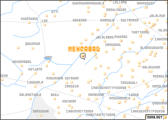
Mehrābād (Punjab, Pakistan)Mehrābād is a town in the Punjab region of Pakistan. An overview map of the region around Mehrābād is displayed below.
regional and 3d topo map of Mehrābād, Pakistan ::
Mehrābād airports ::
The nearest airport is LYP - Faisalabad Intl, located 94.7 km south of Mehrābād.
Other airports nearby include ISB - Islamabad Chaklala (160.9 km north), LHE - Lahore Allama Iqbal Intl (172.7 km south east), RAZ - Rawala Kot Rawalakot (207.7 km north east), PEW - Peshawar Intl (230.9 km north west), Nearby towns ::
Ajrānwān da Dera (1.5km north) //
Chak Twenty NB (2.4km north east) //
Templerābād (2.4km east) //
Waraichānwāla (2.8km south east) //
Sādiān ka Dera (3.7km north) //
Chak Twenty-eight NB (3.4km east) //
Khizarābād (4.6km north) //
Chak Twenty-nine NB (4.8km south) //
Kot Kaura (5.0km south) //
Chak Twenty-five NB (4.6km north east) //
Ajnāla (5.0km south east) //
Malakpur (4.9km east) //
Kot Āwān (5.5km south west) //
Bhatta Chak Sixty (6.1km north) //
Jalālābād (5.7km north east) //
Mahlanwāla (6.0km south west) //
Risāla (5.8km south east) //
Chak Thirty NB (6.3km south east) //
Mangowāl (6.0km north east) //
Kot Allāh Bakhsh (7.2km north) //
Zangeza (7.2km south) //
Chak Sixty-one NB (7.3km north) //
Bilochānwāla (6.6km south west) //
Chak Twenty-six NB (6.5km east) //
Māri (6.6km west) //
Chak Jarma (7.9km south) //
Sakesar (8.1km north) //
Pindi Miāna (7.4km south west) //
Kot Allozai (7.4km south west) //
[all distances 'as the bird flies' and approximate] 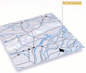 Places with similar names to Mehrābād, Pakistan ::
Disclaimer :: Information on this page comes without warranty of any kind |
||
|
Where is Mehrābād? Elevation and coordinates ::
Latitude (lat): 32°11'40"N Longitude (lon): 72°45'30"E
Elevation (approx.): 192m (map arrows pan, magnifying glasses zoom) |
||
|
Visiting Mehrābād? Hotel/Accommodation ::
Book a hotel in Mehrābād Travel Guide ::
Buy a travel guide for Pakistan rental cars ::
car rental offers GPS waypoint ::
download a GPX waypoint (PoI) of Mehrābād for your GPS receiver
|
||