|
search place name
|
||
Miān Khān Got (Balochistān, Pakistan)Miān Khān Got is a town in the Balochistān region of Pakistan. An overview map of the region around Miān Khān Got is displayed below.
regional and 3d topo map of Miān Khān Got, Pakistan ::

Miān Khān Got airports ::
The nearest airport is UET - Quetta, located 43.7 km north of Miān Khān Got.
Other airports nearby include KDH - Kandahar (216.2 km north west), Nearby towns ::
Ghulām Nabi Goth (0.6km north west) //
Dasht (3.7km north) //
Qādir Bakhsh (3.6km west) //
Kolpur (3.7km north east) //
Miskān (4.0km west) //
Khūni Parāo (4.6km north) //
Ali Muhammad (4.8km north) //
Mazār Khān (5.4km north west) //
Wali Muhammad (5.3km north west) //
Sārang Khān (5.2km south west) //
Abdul Karīm (5.8km north) //
Tauq Ali (5.6km north west) //
Tūrkān (5.7km south west) //
Sher Muhammad (5.9km south west) //
Lāl Muhammad (7.1km north west) //
Umar Khān (6.9km north west) //
Khudādād (7.0km west) //
Jamālān (8.1km north) //
Afzal Khān (7.6km south west) //
Dinna Khān (8.0km north west) //
Muhammad Khān (8.3km north west) //
Lawang Khān (8.2km north west) //
Saīd Ullah (9.1km north west) //
Yār Ali (9.0km north west) //
Dozān (9.8km north east) //
Shāh Mīr (9.8km north west) //
Mastān Khān (10.3km south west) //
[all distances 'as the bird flies' and approximate] 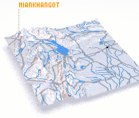 Places with similar names to Miān Khān Got, Pakistan :: Disclaimer :: Information on this page comes without warranty of any kind |
||
|
Where is Miān Khān Got? Elevation and coordinates ::
Latitude (lat): 29°53'0"N Longitude (lon): 67°6'0"E
Elevation (approx.): 1775m (map arrows pan, magnifying glasses zoom) |
||
|
Visiting Miān Khān Got? Hotel/Accommodation ::
Book a hotel in Miān Khān Got Travel Guide ::
Buy a travel guide for Pakistan rental cars ::
car rental offers GPS waypoint ::
download a GPX waypoint (PoI) of Miān Khān Got for your GPS receiver
|
||