|
search place name
|
||
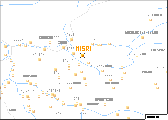
Misri (Balochistān, Pakistan)Misri is a town in the Balochistān region of Pakistan. An overview map of the region around Misri is displayed below.
regional and 3d topo map of Misri, Pakistan ::
Misri airports ::
The nearest airport is UET - Quetta, located 106.1 km south of Misri.
Other airports nearby include KDH - Kandahar (113.6 km west), Nearby towns ::
Tor Kach (1.2km south east) //
Ziābo (1.4km south west) //
Zāfrān (2.4km north west) //
Borāgai (2.8km south) //
Makān (3.0km south) //
Bābar (3.3km north east) //
Tāj Mīr (3.0km south west) //
Wuchākai (3.6km south west) //
Hāji Dād (3.4km south west) //
Zozlan (3.9km north east) //
Amīr Muhammad (4.2km south) //
Khara (4.3km north east) //
Muhammad Wāl (4.3km south east) //
Suhbat (4.5km north east) //
Ziāba (4.7km north west) //
Ayūb (5.1km north west) //
Lashtai (5.6km south) //
Mulla Haidar (4.9km west) //
Ghāzi Bāgh (5.4km south east) //
Qudsai (5.5km north west) //
Saidāl (5.8km west) //
Kaholai Khara (6.0km north east) //
Mundai (6.8km south) //
Salīm (6.2km south west) //
Abdur Rahmān (6.8km south) //
Kunsat (6.5km north west) //
Zwārand (6.8km south east) //
Khān Khwara (7.5km north west) //
Wali Muhammad (7.7km south west) //
[all distances 'as the bird flies' and approximate] 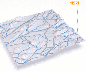 Places with similar names to Misri, Pakistan ::
Disclaimer :: Information on this page comes without warranty of any kind |
||
|
Where is Misri? Elevation and coordinates ::
Latitude (lat): 31°12'25"N Longitude (lon): 66°59'25"E
Elevation (approx.): 1949m (map arrows pan, magnifying glasses zoom) |
||
|
Visiting Misri? Hotel/Accommodation ::
Book a hotel in Misri Travel Guide ::
Buy a travel guide for Pakistan rental cars ::
car rental offers GPS waypoint ::
download a GPX waypoint (PoI) of Misri for your GPS receiver
|
||