|
search place name
|
||
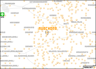
Mua Chora (Sind, Pakistan)Mua Chora is a town in the Sind region of Pakistan. An overview map of the region around Mua Chora is displayed below.
regional and 3d topo map of Mua Chora, Pakistan ::
Mua Chora airports ::
The nearest airport is WNS - Nawabshah, located 17.7 km north west of Mua Chora.
Other airports nearby include MJD - Moenjodaro (137.4 km north), BDN - Talhar (147.8 km south), SKZ - Sukkur (175.8 km north), KHI - Karachi Jinnah Intl (196.1 km south west), Nearby towns ::
Nizāmuddīn Khoso (0.3km west) //
Nizāmuddīn Khoso (0.4km west) //
Mulla Jalīl (0.8km south west) //
Muhammad Khān Mugheri (1.1km north east) //
Dost Muhammad Khoso (1.2km north west) //
Muhammad Yusuf Siāl (1.6km north) //
Jhoranjo (1.7km east) //
Hāji Rājio Bughio (2.0km south east) //
Dāim Jalbāni (2.1km north east) //
Ilyās Kirio (2.4km south) //
Jarār Dāhri (2.2km south east) //
Hāji Sādiq Marri (2.4km north west) //
Hāmid Dāhri (2.5km south east) //
Ghulām Muleja (2.5km south west) //
Gul Khatiān (2.5km north east) //
Mūhammad Siddique Siāl (2.4km west) //
Hāji Pīr Bakhsh (2.6km north west) //
Jāh Muhammad Marri (2.5km west) //
Khoso (2.6km north west) //
Khamiso Jalbāni (2.5km east) //
Ghulām Kirio (2.8km south west) //
Hāji Qaisar Khān (2.9km south) //
Jumma Khān Jalbāni (3.2km south) //
Hākim Khān (3.3km north west) //
Bhiru Zardāri (3.3km south east) //
Nabi Bakhsh Khosa (3.6km north west) //
Hāji Gul Muhammad (3.6km north east) //
Gul Hasan Siāl (3.7km north east) //
Bachal Zardāri (3.8km south east) //
[all distances 'as the bird flies' and approximate] 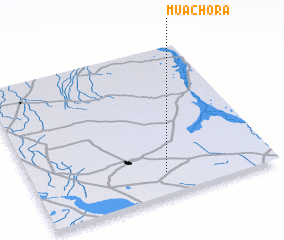 Places with similar names to Mua Chora, Pakistan ::
Disclaimer :: Information on this page comes without warranty of any kind |
||
|
Where is Mua Chora? Elevation and coordinates ::
Latitude (lat): 26°9'0"N Longitude (lon): 68°33'0"E
Elevation (approx.): 27m (map arrows pan, magnifying glasses zoom) |
||
|
Visiting Mua Chora? Hotel/Accommodation ::
Book a hotel in Mua Chora Travel Guide ::
Buy a travel guide for Pakistan rental cars ::
car rental offers GPS waypoint ::
download a GPX waypoint (PoI) of Mua Chora for your GPS receiver
|
||