|
search place name
|
||
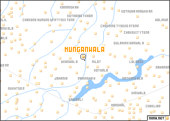
Mungānwāla (Punjab, Pakistan)Mungānwāla is a town in the Punjab region of Pakistan. An overview map of the region around Mungānwāla is displayed below.
regional and 3d topo map of Mungānwāla, Pakistan ::
Mungānwāla airports ::
The nearest airport is MUX - Multan Intl, located 44.9 km west of Mungānwāla.
Other airports nearby include LYP - Faisalabad Intl (179.1 km north east), RYK - Rahim Yar Khan Sheikh Zayed (242.9 km south west), Nearby towns ::
Hashmatābād (1.4km south) //
Chak One Hundred Four A Ten R (1.9km north east) //
Kot Rajāda (2.2km north west) //
Nīlot (2.8km south east) //
Bhagwānpur (2.8km west) //
Chak One Hundred Ten-Ten R (3.2km south west) //
Ukānwāla (3.1km south west) //
Jahāngīrpur (3.1km south west) //
Chak One Hundred Fifty-nine-Ten R (4.3km north) //
Mughalwāla Araiyān (4.3km north east) //
Kotwāla (4.6km south east) //
Rahīm Shāh (5.1km south) //
Chak One Hundred Fifty-Ten R (4.6km north west) //
Chak One Hundred Two-Ten R (4.9km north east) //
Chak One Hundred-Ten R (4.6km east) //
Chak One Hundred Forty-nine-Ten R (4.8km west) //
Zafarābād (5.0km east) //
Chak One Hundred Fifty-one-Ten R (5.8km north west) //
Chak One Hundred Forty-six-Seven R (6.0km south) //
Chak One Hundred Fifteen-Ten R (6.2km south) //
Khalilpur (6.3km north) //
Mohkamwāla (5.7km east) //
Godarwāla (6.1km south east) //
Chak One Hundred Forty-eight-Ten R (5.9km west) //
Chak One Hundred Fifty-eight-Ten R (6.9km north) //
Chak One Hundred Forty-seven-Ten R (6.2km west) //
Jahānia (6.7km south west) //
Mirzāpur (7.2km south) //
Chak One Hundred Fifty-one-Ten R (7.2km north) //
[all distances 'as the bird flies' and approximate] 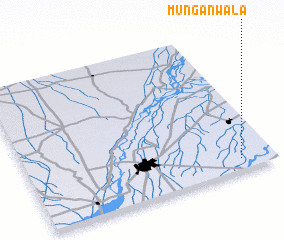 Places with similar names to Mungānwāla, Pakistan ::
Disclaimer :: Information on this page comes without warranty of any kind |
||
|
Where is Mungānwāla? Elevation and coordinates ::
Latitude (lat): 30°4'45"N Longitude (lon): 71°51'45"E
Elevation (approx.): 131m (map arrows pan, magnifying glasses zoom) |
||
|
Visiting Mungānwāla? Hotel/Accommodation ::
Book a hotel in Mungānwāla Travel Guide ::
Buy a travel guide for Pakistan rental cars ::
car rental offers GPS waypoint ::
download a GPX waypoint (PoI) of Mungānwāla for your GPS receiver
|
||