|
search place name
|
||
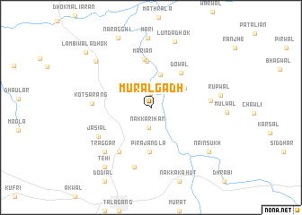
Murāl Gadh (Punjab, Pakistan)Murāl Gadh is a town in the Punjab region of Pakistan. An overview map of the region around Murāl Gadh is displayed below.
regional and 3d topo map of Murāl Gadh, Pakistan ::
Murāl Gadh airports ::
The nearest airport is ISB - Islamabad Chaklala, located 88.4 km north east of Murāl Gadh.
Other airports nearby include PEW - Peshawar Intl (137.6 km north west), RAZ - Rawala Kot Rawalakot (154.5 km north east), MFG - Muzaffarabad (174.9 km north east), LYP - Faisalabad Intl (191.9 km south), Nearby towns ::
Morāli (1.8km north) //
Nakka Rihān (2.6km south) //
Maliāna Dhok (4.2km north) //
Kahulwāli Dhok (4.3km north east) //
Pīra Jāngla (5.5km south) //
Dowāl (5.3km north east) //
Maliaran (5.7km north) //
Marian (6.0km north) //
Chatwāl (6.4km south west) //
Kot Sārang (6.1km west) //
Kot Khalan (6.2km east) //
Jasiāl (6.6km south west) //
Dhok Mariānwāli (7.6km south) //
Traggar (7.4km south west) //
Māri (8.6km north) //
Lunda Dhok (8.6km north) //
Rūpwāl (7.4km east) //
Bhirh Dhok (8.1km north west) //
Nain Sukh (8.2km south east) //
Tehi (8.8km south west) //
Naragghi (9.3km north) //
Lambīwāla Dhok (9.6km north west) //
[all distances 'as the bird flies' and approximate] 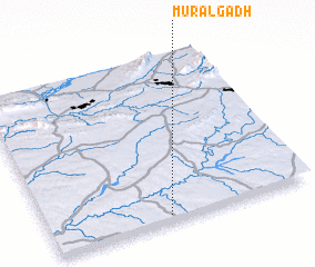 Places with similar names to Murāl Gadh, Pakistan ::
// Miriālgūda (IN)
// Marulakuta (NA)
Disclaimer :: Information on this page comes without warranty of any kind |
||
|
Where is Murāl Gadh? Elevation and coordinates ::
Latitude (lat): 33°1'59"N Longitude (lon): 72°27'7"E
Elevation (approx.): 421m (map arrows pan, magnifying glasses zoom) |
||
|
Visiting Murāl Gadh? Hotel/Accommodation ::
Book a hotel in Murāl Gadh Travel Guide ::
Buy a travel guide for Pakistan rental cars ::
car rental offers GPS waypoint ::
download a GPX waypoint (PoI) of Murāl Gadh for your GPS receiver
|
||