|
search place name
|
||
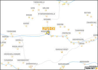
Musaki (Federally Administered Tribal Areas, Pakistan)Musaki is a town in the Federally Administered Tribal Areas region of Pakistan. An overview map of the region around Musaki is displayed below.
regional and 3d topo map of Musaki, Pakistan ::
Musaki airports ::
The nearest airport is PZH - Zhob, located 172.4 km south of Musaki.
Other airports nearby include JAA - Jalalabad (179.1 km north), PEW - Peshawar Intl (186.8 km north east), KBL - Kabul Intl (208.7 km north), Nearby towns ::
Somiakonr (0.8km south east) //
Asad Khel (1.2km north west) //
Spin Khorai (1.2km east) //
Damdil (2.4km north) //
Sangiri Khula (2.5km east) //
Raghzai (4.3km east) //
Anghar (5.1km north) //
Sarobi (4.8km north east) //
Gurgurai Jai (4.5km east) //
Zarpezai (5.6km east) //
Jaler (5.9km north east) //
Malik Khel Kili (6.0km east) //
Star Sarobai Mela (7.3km north) //
Shamīri (6.6km east) //
Shahīd Ziārat (7.7km south east) //
Dakai Shahīd (7.7km south east) //
Shaikh Muhammad Ziārat (7.6km east) //
Tarai (8.4km north west) //
Khron (8.1km north west) //
Pingai (9.3km north west) //
[all distances 'as the bird flies' and approximate]  Places with similar names to Musaki, Pakistan ::
Disclaimer :: Information on this page comes without warranty of any kind |
||
|
Where is Musaki? Elevation and coordinates ::
Latitude (lat): 32°49'32"N Longitude (lon): 70°4'7"E
Elevation (approx.): 1187m (map arrows pan, magnifying glasses zoom) |
||
|
Visiting Musaki? Hotel/Accommodation ::
Book a hotel in Musaki Travel Guide ::
Buy a travel guide for Pakistan rental cars ::
car rental offers GPS waypoint ::
download a GPX waypoint (PoI) of Musaki for your GPS receiver
|
||