|
search place name
|
||
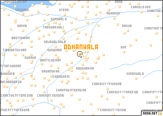
Odhanwāla (Punjab, Pakistan)Odhanwāla is a town in the Punjab region of Pakistan. An overview map of the region around Odhanwāla is displayed below.
regional and 3d topo map of Odhanwāla, Pakistan ::
Odhanwāla airports ::
The nearest airport is MUX - Multan Intl, located 107.0 km north of Odhanwāla.
Other airports nearby include RYK - Rahim Yar Khan Sheikh Zayed (155.4 km south west), Nearby towns ::
Shāhwāla (0.5km north east) //
Basti Jaman Shāh (0.8km east) //
Basti Bhattiān (1.1km south east) //
Basti Mochian (1.2km east) //
Marai (1.6km south) //
Dera Gobind (1.5km north east) //
Lodhrān (2.0km north east) //
Pakhlān (2.3km north west) //
Basti Bigga Mal (2.3km north west) //
Goth Mahrāb (2.3km south west) //
Goth Mehru (2.7km north) //
Māri Mīr Muhammad (3.0km south west) //
Basti Kabīr Khān (3.2km north) //
Mochīwāla (3.4km south) //
Goth Lāl (3.0km east) //
Naushahra (3.6km south) //
Basti Mehrān (3.2km east) //
Basti Charohiān (3.3km south west) //
Ditta Baloch (3.6km south west) //
Sardar Baloch (3.5km north west) //
Jhok Arāīn (3.7km south west) //
Malwārīn (3.5km east) //
Wāhi Gosāīn (3.9km north east) //
Gānwar Shāh (4.4km north east) //
Pushān (4.5km south) //
Habīb Misan (4.6km north) //
Kumhārwāla (4.9km south) //
Rangpur (4.9km south) //
Kirāni (4.5km east) //
[all distances 'as the bird flies' and approximate]  Places with similar names to Odhanwāla, Pakistan :: Disclaimer :: Information on this page comes without warranty of any kind |
||
|
Where is Odhanwāla? Elevation and coordinates ::
Latitude (lat): 29°14'35"N Longitude (lon): 71°32'15"E
Elevation (approx.): 113m (map arrows pan, magnifying glasses zoom) |
||
|
Visiting Odhanwāla? Hotel/Accommodation ::
Book a hotel in Odhanwāla Travel Guide ::
Buy a travel guide for Pakistan rental cars ::
car rental offers GPS waypoint ::
download a GPX waypoint (PoI) of Odhanwāla for your GPS receiver
|
||