|
search place name
|
||
Odigrām (Federally Administered Tribal Areas, Pakistan)Odigrām is a town in the Federally Administered Tribal Areas region of Pakistan. An overview map of the region around Odigrām is displayed below.
regional and 3d topo map of Odigrām, Pakistan ::

Odigrām airports ::
The nearest airport is SDT - Saidu Sharif, located 80.8 km east of Odigrām.
Other airports nearby include PEW - Peshawar Intl (98.7 km south), JAA - Jalalabad (104.2 km south west), ISB - Islamabad Chaklala (205.3 km south east), Nearby towns ::
Daman (1.0km south east) //
Kansair (1.4km north west) //
Jabrarai (1.4km north east) //
Chūrak (1.2km east) //
Shīngergul (1.9km south east) //
Loegrām (2.1km east) //
Dabar (2.3km north west) //
Sagargām (2.6km north) //
Okashīn (2.6km north west) //
Adam Shagai (3.0km north) //
Loe Kili (3.1km north west) //
Shah Sarāi (2.7km east) //
Batmalai (3.5km south east) //
Kādok (3.5km north east) //
Gatkai (3.4km east) //
Lakian (4.1km north) //
Dandkoi (3.8km east) //
Gabar (4.0km north east) //
Shāhi Tangai (4.1km south west) //
Shāh Karo (3.9km west) //
Letai (4.7km north) //
Lakiān (4.3km north east) //
Rāja Bānda (4.0km north west) //
Bajezo Bānda (4.8km south west) //
Dandukai (4.2km east) //
Kharkai Nāo (4.2km west) //
Mulla Saiyid (5.1km south) //
Chilārgam (4.7km south east) //
Arkhai (4.6km north east) //
[all distances 'as the bird flies' and approximate] 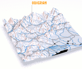
Disclaimer :: Information on this page comes without warranty of any kind |
||
|
Where is Odigrām? Elevation and coordinates ::
Latitude (lat): 34°53'0"N Longitude (lon): 71°28'25"E
Elevation (approx.): 1156m (map arrows pan, magnifying glasses zoom) |
||
|
Visiting Odigrām? Hotel/Accommodation ::
Book a hotel in Odigrām Travel Guide ::
Buy a travel guide for Pakistan rental cars ::
car rental offers GPS waypoint ::
download a GPX waypoint (PoI) of Odigrām for your GPS receiver
|
||