|
search place name
|
||
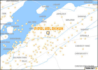
Pipalwāla Khūh (Punjab, Pakistan)Pipalwāla Khūh is a town in the Punjab region of Pakistan. An overview map of the region around Pipalwāla Khūh is displayed below.
regional and 3d topo map of Pipalwāla Khūh, Pakistan ::
Pipalwāla Khūh airports ::
The nearest airport is MUX - Multan Intl, located 106.8 km north west of Pipalwāla Khūh.
Other airports nearby include LYP - Faisalabad Intl (193.6 km north), Nearby towns ::
Godri (0.7km south west) //
Basti Saifarwāla (0.8km south) //
Jalāni (1.0km north) //
Basti Shāhpur (1.0km east) //
Mīram (1.2km north) //
Sardārpur (1.4km west) //
Sehol (2.2km north) //
Kallarwāla Khūh (2.0km east) //
Lākhat (2.2km south) //
Basti Bari Shāh (2.5km north east) //
Bāla (2.6km north) //
Halīmpur (2.6km north west) //
Wains (2.5km south west) //
Sehol (2.5km north east) //
Awwal Khān (2.8km south) //
Shāhbāzpur (3.1km north east) //
Basti Jhalār (2.8km west) //
Rangbarāh (3.2km south) //
Kothewāla Khūh (2.9km west) //
Quraishiwāla Khūh (3.6km south) //
Khamīsa (3.4km north east) //
Bhattiān di Basti (3.4km south east) //
Nawān Khūh (3.7km south) //
Khalīfawāla Khūh (3.4km east) //
Jandāni (3.8km north) //
Luthrewāli (4.1km south) //
Ināyati (3.7km west) //
Wains (4.3km north) //
Shilān di Basti (4.2km north east) //
[all distances 'as the bird flies' and approximate] 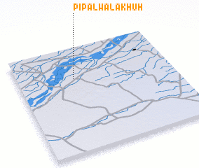 Places with similar names to Pipalwāla Khūh, Pakistan ::
// Pīpalwāla Khu (PK)
Disclaimer :: Information on this page comes without warranty of any kind |
||
|
Where is Pipalwāla Khūh? Elevation and coordinates ::
Latitude (lat): 29°42'20"N Longitude (lon): 72°22'0"E
Elevation (approx.): 134m (map arrows pan, magnifying glasses zoom) |
||
|
Visiting Pipalwāla Khūh? Hotel/Accommodation ::
Book a hotel in Pipalwāla Khūh Travel Guide ::
Buy a travel guide for Pakistan rental cars ::
car rental offers GPS waypoint ::
download a GPX waypoint (PoI) of Pipalwāla Khūh for your GPS receiver
|
||