|
search place name
|
||
Ramdayālwāla (Punjab, Pakistan)Ramdayālwāla is a town in the Punjab region of Pakistan. An overview map of the region around Ramdayālwāla is displayed below.
regional and 3d topo map of Ramdayālwāla, Pakistan ::

Ramdayālwāla airports ::
The nearest airport is MUX - Multan Intl, located 115.3 km south of Ramdayālwāla.
Other airports nearby include LYP - Faisalabad Intl (135.1 km east), Nearby towns ::
Kariālīwāla (0.9km south east) //
Mohanwāla (1.1km north west) //
Banglāwāla Sharqi (1.3km south) //
Jinde Thinawāla (1.9km north) //
Nawān Wadūwāla (2.0km south) //
Jindāwāla (2.2km north) //
Khānāwāla (3.1km north west) //
Jandwāla (3.2km south) //
Thakrawāla (2.9km west) //
Utmewāla (3.9km south) //
Vichlāwāla (3.5km west) //
Banglāwāla Gharbi (4.0km south west) //
Māchīwāla (4.6km north) //
Jaisewāla (4.5km south east) //
Jhangārwāla (4.8km north) //
Bakhshāwāla (4.2km west) //
Barewāla (4.2km west) //
Nawān Sethiānwāla (4.3km west) //
Takāwāla (5.0km south) //
Nawān Bappīwāla (4.7km south west) //
Sathārwāla (4.7km north west) //
Kherāwāla (4.8km south west) //
Nawān Bakhshewāla (4.9km south west) //
Khānwāla Shimāli (5.3km south west) //
Ālam Sherwāla (5.2km east) //
Barangīwāla (5.3km east) //
Bakāwāla (6.2km north) //
Shirīwāla (5.5km north west) //
Bahādurwāla (5.6km south west) //
[all distances 'as the bird flies' and approximate] 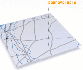 Places with similar names to Ramdayālwāla, Pakistan :: Disclaimer :: Information on this page comes without warranty of any kind |
||
|
Where is Ramdayālwāla? Elevation and coordinates ::
Latitude (lat): 31°14'0"N Longitude (lon): 71°35'3"E
Elevation (approx.): 155m (map arrows pan, magnifying glasses zoom) |
||
|
Visiting Ramdayālwāla? Hotel/Accommodation ::
Book a hotel in Ramdayālwāla Travel Guide ::
Buy a travel guide for Pakistan rental cars ::
car rental offers GPS waypoint ::
download a GPX waypoint (PoI) of Ramdayālwāla for your GPS receiver
|
||