|
search place name
|
||
Rang Shāh (Punjab, Pakistan)Rang Shāh is a town in the Punjab region of Pakistan. An overview map of the region around Rang Shāh is displayed below.
regional and 3d topo map of Rang Shāh, Pakistan ::

Rang Shāh airports ::
The nearest airport is LYP - Faisalabad Intl, located 70.6 km north of Rang Shāh.
Other airports nearby include MUX - Multan Intl (153.9 km west), LHE - Lahore Allama Iqbal Intl (167.9 km north east), ATQ - Amritsar (210.7 km north east), IXJ - Jammu (284.2 km north east), Nearby towns ::
Nūran Sanpāl (0.0km north) //
Juttiwāla (1.2km south east) //
Rang Shāh (1.6km south east) //
Hakīm Ke Kāthia (1.6km west) //
Samundarwāla (1.6km east) //
Nāme ke Kāthia (1.6km west) //
Shādi Ke Dullu (2.1km north) //
Bela Budhu (2.1km east) //
Murīd ke Tulle (3.1km south) //
Thatta Shahāmad (3.5km north east) //
Tulla Bhulla (3.7km south) //
Ālam Shāh Tāja (3.2km west) //
Bego Saboke (3.5km east) //
Sāhib ke Vahniwāl (3.8km west) //
Chāh Chaugewāla (4.1km north west) //
Bahāb ke Kāthia (4.6km south) //
Khāgiānwāli Basti (4.8km south east) //
Jīwan Shāh (4.9km south east) //
Rāja Dullu (4.9km north west) //
Basti Jammu Dullu (5.1km north east) //
Panjiāne (5.5km south) //
Murād Dullu (5.1km east) //
Azmat ke Kāthia (5.8km south) //
Āde ke Sagle (6.0km south) //
Tarsānwāla (5.9km north west) //
Tukra Twenty-six (6.0km south west) //
Lakhkhu ke Dullu (6.1km north east) //
Thatta Dālat ka (6.0km north west) //
Chāh Pīpalwāla (6.4km north west) //
[all distances 'as the bird flies' and approximate] 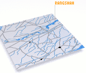 Places with similar names to Rang Shāh, Pakistan ::
Disclaimer :: Information on this page comes without warranty of any kind |
||
|
Where is Rang Shāh? Elevation and coordinates ::
Latitude (lat): 30°44'0"N Longitude (lon): 72°54'0"E
Elevation (approx.): 162m (map arrows pan, magnifying glasses zoom) |
||
|
Visiting Rang Shāh? Hotel/Accommodation ::
Book a hotel in Rang Shāh Travel Guide ::
Buy a travel guide for Pakistan rental cars ::
car rental offers GPS waypoint ::
download a GPX waypoint (PoI) of Rang Shāh for your GPS receiver
|
||