|
search place name
|
||
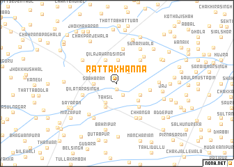
Ratta Khanna (Punjab, Pakistan)Ratta Khanna is a town in the Punjab region of Pakistan. An overview map of the region around Ratta Khanna is displayed below.
regional and 3d topo map of Ratta Khanna, Pakistan ::
Ratta Khanna airports ::
The nearest airport is LYP - Faisalabad Intl, located 97.7 km north west of Ratta Khanna.
Other airports nearby include LHE - Lahore Allama Iqbal Intl (115.1 km north east), ATQ - Amritsar (155.4 km north east), IXJ - Jammu (246.9 km north east), IXP - Pathankot (252.8 km north east), Nearby towns ::
Jalālkot (0.9km south) //
Mīrbāz (2.0km south east) //
Saiyidān Sāīn (2.4km north east) //
Tahsīl (3.5km south west) //
Sobha Rām (3.2km west) //
Chak Imāmuddīn (3.7km north) //
Chak Jawāhir Singh (3.5km north west) //
Dīpālpur (4.0km south west) //
Qila Jawand Singh (4.0km north west) //
Farīdkot (3.7km south east) //
Kot Dayāl Singh (4.0km south east) //
Charat Singhwāla (4.8km south east) //
Wāghra (4.9km north east) //
Wanjhal (4.6km east) //
Basti Bhattiān (5.6km north) //
Qila Tāra Singh (5.1km west) //
Shāmdīn (5.7km north east) //
Bakshewāla (6.2km south east) //
Khairpur (6.3km south west) //
Chak Fazal Shāh (6.0km north west) //
Chhānga (6.4km south east) //
Sunāriwāla (6.4km north east) //
Qila Hari Chandwāla (6.4km south west) //
Subhān Shāh (5.8km east) //
Jaj (6.4km east) //
Sabzpura (7.3km north) //
Bāhrīpur (7.6km south) //
Tibbi Sadda Singh (7.0km east) //
Chak Parjewāla (7.7km north west) //
[all distances 'as the bird flies' and approximate]  Places with similar names to Ratta Khanna, Pakistan ::
// Rāi Tikhāna (IN)
// Rūd-e Khīn (IR)
// Rūdkhāneh (IR)
// Rūdkhāneh (IR)
// Rūdkhāneh (IR)
// Rūdkhāneh (IR)
// Rūdkhāneh (IR)
// Rūdkhāneh (IR)
// Radukhino (RU)
Disclaimer :: Information on this page comes without warranty of any kind |
||
|
Where is Ratta Khanna? Elevation and coordinates ::
Latitude (lat): 30°42'0"N Longitude (lon): 73°40'0"E
Elevation (approx.): 171m (map arrows pan, magnifying glasses zoom) |
||
|
Visiting Ratta Khanna? Hotel/Accommodation ::
Book a hotel in Ratta Khanna Travel Guide ::
Buy a travel guide for Pakistan rental cars ::
car rental offers GPS waypoint ::
download a GPX waypoint (PoI) of Ratta Khanna for your GPS receiver
|
||