|
search place name
|
||
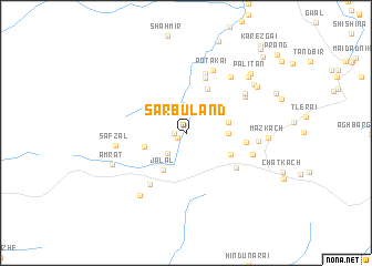
Sarbuland (Balochistān, Pakistan)Sarbuland is a town in the Balochistān region of Pakistan. An overview map of the region around Sarbuland is displayed below.
regional and 3d topo map of Sarbuland, Pakistan ::
Sarbuland airports ::
The nearest airport is UET - Quetta, located 84.8 km south of Sarbuland.
Other airports nearby include KDH - Kandahar (101.5 km north west), Nearby towns ::
Hāji Bahādur (0.9km south west) //
Hāji Dād Muhammad (1.1km west) //
Kāmrān (2.6km south west) //
Atar Kach (3.6km east) //
Adozo Zrandah (3.8km north east) //
Orakzai Zrandah (3.7km east) //
Jalāl (4.2km south west) //
Kārezgai (3.8km west) //
Māku Kach (4.4km south east) //
Alīzo Zrandah (4.8km north) //
Sālehzai (5.8km north) //
Timarguli Bāgh (5.5km south east) //
Saudād Bāgh (5.2km east) //
Hāji Sharīf Ghundai (6.0km south west) //
Jilga (6.2km north) //
Potakai (6.7km north) //
Hadīra Kach (6.2km north east) //
Akram Kach (6.1km east) //
Hāji Tawāno (6.4km north east) //
Safzal (6.2km west) //
Tor Kach (6.9km north east) //
Meoak Bāgh (6.3km east) //
Hāji (7.3km south west) //
Amrat (7.1km south west) //
Maz Kach (7.0km east) //
Zhalan (7.6km north east) //
Wuchākai War (7.8km north east) //
Darakht Kach (7.7km north east) //
Palitan (8.2km north east) //
[all distances 'as the bird flies' and approximate] 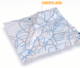
Disclaimer :: Information on this page comes without warranty of any kind |
||
|
Where is Sarbuland? Elevation and coordinates ::
Latitude (lat): 30°59'45"N Longitude (lon): 66°44'0"E
Elevation (approx.): 2149m (map arrows pan, magnifying glasses zoom) |
||
|
Visiting Sarbuland? Hotel/Accommodation ::
Book a hotel in Sarbuland Travel Guide ::
Buy a travel guide for Pakistan rental cars ::
car rental offers GPS waypoint ::
download a GPX waypoint (PoI) of Sarbuland for your GPS receiver
|
||