|
search place name
|
||
Sari Sing (Sind, Pakistan)Sari Sing is a town in the Sind region of Pakistan. An overview map of the region around Sari Sing is displayed below.
regional and 3d topo map of Sari Sing, Pakistan ::

Sari Sing airports ::
The nearest airport is KHI - Karachi Jinnah Intl, located 60.0 km south west of Sari Sing.
Other airports nearby include WNS - Nawabshah (131.1 km north east), BDN - Talhar (136.8 km east), Nearby towns ::
Goth Baloch (4.4km north) //
Goth Bacho (5.6km south) //
Goth Alū (6.1km south) //
Goth Khado (6.2km south) //
Goth Rādnon Shodo (5.8km east) //
Goth Jamāl (5.8km east) //
Goth Murād (6.3km south west) //
Goth Ummed Ali (6.7km south west) //
Goth Rakhio (7.2km south east) //
Goth Satobo (8.2km north) //
Goth Jumo (8.3km south west) //
Goth Barād (8.5km north) //
Goth Jumo (8.4km south east) //
Goth Sanāsi (8.8km south east) //
Goth Husain (8.8km south east) //
[all distances 'as the bird flies' and approximate] 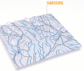 Places with similar names to Sari Sing, Pakistan ::
// Sierżniki (PL)
// Cirsinieki (LV)
// Sarsank (IQ)
// Sarsing (IQ)
// Zaorosongou (CF)
// Sar-e Sang (IR)
// Zar Sonowk (IR)
// Sarsang (PK)
// Sārsang (PK)
// Sirisanga (NG)
Disclaimer :: Information on this page comes without warranty of any kind |
||
|
Where is Sari Sing? Elevation and coordinates ::
Latitude (lat): 25°17'38"N Longitude (lon): 67°34'35"E
Elevation (approx.): 255m (map arrows pan, magnifying glasses zoom) |
||
|
Visiting Sari Sing? Hotel/Accommodation ::
Book a hotel in Sari Sing Travel Guide ::
Buy a travel guide for Pakistan rental cars ::
car rental offers GPS waypoint ::
download a GPX waypoint (PoI) of Sari Sing for your GPS receiver
|
||