|
search place name
|
||
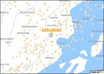
Sarjāhān (Punjab, Pakistan)Sarjāhān is a town in the Punjab region of Pakistan. An overview map of the region around Sarjāhān is displayed below.
regional and 3d topo map of Sarjāhān, Pakistan ::
Sarjāhān airports ::
The nearest airport is RYK - Rahim Yar Khan Sheikh Zayed, located 74.0 km south of Sarjāhān.
Other airports nearby include SUL - Sui (126.3 km west), MUX - Multan Intl (162.6 km north east), SKZ - Sukkur (214.4 km south west), Nearby towns ::
Chāwalenwāla (0.7km north west) //
Taramuwāla (1.5km south) //
Sabrājwāla (1.6km south) //
Mad Agil (1.5km north east) //
Saranwāla (1.9km south) //
Nazruwāla (1.9km west) //
Mad Mairāb (2.4km north east) //
Ultimwāla (2.7km north west) //
Jharbhar (2.9km south) //
Mūsawāla (2.7km south west) //
Karam Illāhi Khānwāla (3.0km north) //
Gulluwāli (3.1km north) //
Ranjewāla (3.0km south west) //
Jatwāla (3.3km north west) //
Khāngāh Bachal Shāh (3.1km east) //
Karmawāla (3.6km south west) //
Sultānwāla (3.9km south east) //
Mirānwāla (3.8km east) //
Lāhewāla (4.1km south west) //
Suhāra (4.6km south east) //
Dharaiwāla (4.3km west) //
Sohin (4.8km north west) //
Kotla Ahmad (4.5km north west) //
Kalar (4.7km south east) //
Pīrawāla (4.8km south west) //
Tibbi (4.7km south west) //
Chatāl Rām (4.8km north east) //
Wāng (5.1km south) //
GelaGat (5.0km north east) //
[all distances 'as the bird flies' and approximate]  Places with similar names to Sarjāhān, Pakistan ::
// Sar Jahan (IR)
Disclaimer :: Information on this page comes without warranty of any kind |
||
|
Where is Sarjāhān? Elevation and coordinates ::
Latitude (lat): 29°2'40"N Longitude (lon): 70°23'20"E
Elevation (approx.): 88m (map arrows pan, magnifying glasses zoom) |
||
|
Visiting Sarjāhān? Hotel/Accommodation ::
Book a hotel in Sarjāhān Travel Guide ::
Buy a travel guide for Pakistan rental cars ::
car rental offers GPS waypoint ::
download a GPX waypoint (PoI) of Sarjāhān for your GPS receiver
|
||