|
search place name
|
||
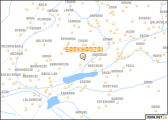
Sar Khānzai (Balochistān, Pakistan)Sar Khānzai is a town in the Balochistān region of Pakistan. An overview map of the region around Sar Khānzai is displayed below.
regional and 3d topo map of Sar Khānzai, Pakistan ::
Sar Khānzai airports ::
The nearest airport is UET - Quetta, located 58.4 km south of Sar Khānzai.
Other airports nearby include KDH - Kandahar (148.5 km north west), Nearby towns ::
Khuddu Sar Khānzai (0.3km north) //
Miān Khānzai (1.4km south west) //
Hāji Nīdah (1.6km east) //
Ghulon (2.9km north east) //
Manzakai (3.0km south east) //
Zingai (3.4km north) //
Khazān (3.4km north) //
Manzakai (3.1km east) //
Spīna Khezai (3.3km north west) //
Inzargai (4.1km north east) //
Shal (4.1km south east) //
Karāwai (4.7km north west) //
Spīn Haud (4.8km north west) //
Wuch Nishk (4.7km north west) //
Pshīn Karaj (4.6km west) //
Goriān (5.7km south) //
Dab Khānzai (5.1km west) //
Shaikhālzai (5.8km south west) //
Sagai (5.6km south east) //
Saiyidān (6.3km south) //
Gohar (5.8km north east) //
Baidar (6.6km north) //
Pshin Karai Maghzai (6.6km north) //
Khushdil Khān Qila (6.6km south west) //
Kamālzai (6.8km south) //
Quddūs (6.5km south east) //
Pākur (6.1km east) //
Māma Nikka (6.3km east) //
Malik Yār (7.2km south west) //
[all distances 'as the bird flies' and approximate] 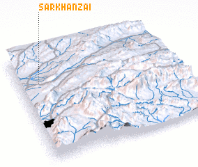 Places with similar names to Sar Khānzai, Pakistan :: Disclaimer :: Information on this page comes without warranty of any kind |
||
|
Where is Sar Khānzai? Elevation and coordinates ::
Latitude (lat): 30°45'0"N Longitude (lon): 67°8'0"E
Elevation (approx.): 1623m (map arrows pan, magnifying glasses zoom) |
||
|
Visiting Sar Khānzai? Hotel/Accommodation ::
Book a hotel in Sar Khānzai Travel Guide ::
Buy a travel guide for Pakistan rental cars ::
car rental offers GPS waypoint ::
download a GPX waypoint (PoI) of Sar Khānzai for your GPS receiver
|
||