|
search place name
|
||
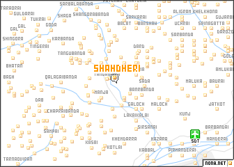
Shāh Dheri (North-West Frontier, Pakistan)Shāh Dheri is a town in the North-West Frontier region of Pakistan. An overview map of the region around Shāh Dheri is displayed below.
regional and 3d topo map of Shāh Dheri, Pakistan ::
Shāh Dheri airports ::
The nearest airport is SDT - Saidu Sharif, located 13.3 km south east of Shāh Dheri.
Other airports nearby include PEW - Peshawar Intl (119.4 km south west), MFG - Muzaffarabad (131.4 km south east), ISB - Islamabad Chaklala (161.7 km south east), JAA - Jalalabad (168.5 km west), Nearby towns ::
Balāgan Bānda (1.3km north west) //
Tangai Wāra (1.4km north west) //
Amlūktal Bānda (2.1km north) //
Miān Bāba Bānda (2.4km north west) //
Malkāna Bānda (2.5km south east) //
Arkot Qila (2.5km south east) //
Sam Deolai (2.5km south east) //
Loar Deolai (2.5km south east) //
Kotgai Bānda (2.5km north west) //
Derai (2.5km south east) //
Pīr Cham (2.8km south) //
Mānja (3.1km south west) //
Taghma (2.9km north east) //
Faqīrān Bānda (3.4km north) //
Godhand Bānda (3.6km south) //
Nasrat (3.4km south east) //
Khar Bānda (3.6km south west) //
Kāshkār Bānda (3.3km south west) //
Tāl (3.8km north west) //
Shālhand (3.4km east) //
Sikka Bānda (4.2km north) //
Tutān Bānda (4.2km south) //
Maira Bānda (4.1km north) //
Ashārai Bānda (3.6km west) //
Bāyān Bānda (3.6km west) //
Banr Bānda (3.8km south east) //
Serai (4.1km north east) //
Sada (3.7km east) //
Bāragat (4.3km north east) //
[all distances 'as the bird flies' and approximate] 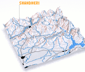 Places with similar names to Shāh Dheri, Pakistan ::
Disclaimer :: Information on this page comes without warranty of any kind |
||
|
Where is Shāh Dheri? Elevation and coordinates ::
Latitude (lat): 34°53'15"N Longitude (lon): 72°14'20"E
Elevation (approx.): 1198m (map arrows pan, magnifying glasses zoom) |
||
|
Visiting Shāh Dheri? Hotel/Accommodation ::
Book a hotel in Shāh Dheri Travel Guide ::
Buy a travel guide for Pakistan rental cars ::
car rental offers GPS waypoint ::
download a GPX waypoint (PoI) of Shāh Dheri for your GPS receiver
|
||