|
search place name
|
||
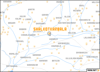
Shalkot Karbala (Balochistān, Pakistan)Shalkot Karbala is a town in the Balochistān region of Pakistan. An overview map of the region around Shalkot Karbala is displayed below.
regional and 3d topo map of Shalkot Karbala, Pakistan ::
Shalkot Karbala airports ::
The nearest airport is UET - Quetta, located 47.5 km south of Shalkot Karbala.
Other airports nearby include KDH - Kandahar (135.6 km north west), Nearby towns ::
Karbala (2.6km south east) //
Tirwa Gari (3.4km north east) //
Pul Gudar (3.8km west) //
Shinghari (4.5km north west) //
Khuni Qila (5.4km south east) //
Kakāza (5.7km north) //
Gāngalzai (6.1km north west) //
Khudādādzai (6.3km south) //
Dori Biānzai (5.9km south east) //
Shakarzai (6.5km north) //
Sīmzai (6.4km north east) //
Ajaibzai (6.6km north) //
Sulaimān Khel (6.4km south east) //
Gorian (6.9km north) //
Hājizai (6.8km north west) //
Bora Shāh (6.4km south west) //
Haikalzai (7.0km south east) //
Rustam Nika Ziārat (6.8km north east) //
Sulaimān Khel (7.3km north west) //
Chawale Gudar (6.9km west) //
Huramzai (7.4km north west) //
Mado (7.2km west) //
Malezai (7.3km east) //
Bakhtarzai (7.8km east) //
Alīzai (8.3km north east) //
Amir Kili (8.2km south west) //
Lamar (8.5km north west) //
Sarānān (9.2km south west) //
Khātai (10.5km north west) //
[all distances 'as the bird flies' and approximate] 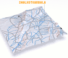 Places with similar names to Shalkot Karbala, Pakistan :: Disclaimer :: Information on this page comes without warranty of any kind |
||
|
Where is Shalkot Karbala? Elevation and coordinates ::
Latitude (lat): 30°40'40"N Longitude (lon): 66°53'37"E
Elevation (approx.): 1481m (map arrows pan, magnifying glasses zoom) |
||
|
Visiting Shalkot Karbala? Hotel/Accommodation ::
Book a hotel in Shalkot Karbala Travel Guide ::
Buy a travel guide for Pakistan rental cars ::
car rental offers GPS waypoint ::
download a GPX waypoint (PoI) of Shalkot Karbala for your GPS receiver
|
||