|
search place name
|
||
Shaudat (Federally Administered Tribal Areas, Pakistan)Shaudat is a town in the Federally Administered Tribal Areas region of Pakistan. An overview map of the region around Shaudat is displayed below.
regional and 3d topo map of Shaudat, Pakistan ::

Shaudat airports ::
The nearest airport is JAA - Jalalabad, located 138.9 km north of Shaudat.
Other airports nearby include PEW - Peshawar Intl (152.8 km north east), KBL - Kabul Intl (179.0 km north west), PZH - Zhob (212.7 km south), Nearby towns ::
Pasta Pal (1.0km east) //
Sir Kamar (1.3km south east) //
Tapākai (1.5km south) //
Zargar (2.0km south) //
Barre Raghza (1.8km east) //
Spolalai (2.6km east) //
Shinkai Khulle (2.8km south west) //
Karangai (3.3km south) //
Chalagai (3.6km south) //
Bāla Khel (5.1km south east) //
Parsha (6.0km south) //
Tsalpezai (5.5km south east) //
Mcwaki Gara (5.3km east) //
Kare Raghzai (5.4km west) //
Man Zhāwar (6.2km north east) //
Shakha (6.5km south west) //
Kājam (7.0km south west) //
Ping (7.2km south west) //
Tande Obo (6.7km west) //
Shinponr (8.4km south east) //
Gulāb Khel (8.6km north east) //
Zira Khel (8.8km north east) //
Titai Kili (9.5km north east) //
[all distances 'as the bird flies' and approximate] 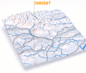 Places with similar names to Shaudat, Pakistan ::
// Chiatat (MA)
// Tiouddit (MA)
// Shadowwood (US)
// Chitid (RO)
// Chododa (RU)
// Shadīdah (IQ)
// Chāh Tūt (IR)
// Shadow Wood (US)
// Shadow Wood (US)
// Chhātādda (BD)
Disclaimer :: Information on this page comes without warranty of any kind |
||
|
Where is Shaudat? Elevation and coordinates ::
Latitude (lat): 33°10'27"N Longitude (lon): 70°11'32"E
Elevation (approx.): 1229m (map arrows pan, magnifying glasses zoom) |
||
|
Visiting Shaudat? Hotel/Accommodation ::
Book a hotel in Shaudat Travel Guide ::
Buy a travel guide for Pakistan rental cars ::
car rental offers GPS waypoint ::
download a GPX waypoint (PoI) of Shaudat for your GPS receiver
|
||