|
search place name
|
||
Sher Ahmad (North-West Frontier, Pakistan)Sher Ahmad is a town in the North-West Frontier region of Pakistan. An overview map of the region around Sher Ahmad is displayed below.
regional and 3d topo map of Sher Ahmad, Pakistan ::

Sher Ahmad airports ::
The nearest airport is PEW - Peshawar Intl, located 153.9 km north east of Sher Ahmad.
Other airports nearby include JAA - Jalalabad (172.4 km north), PZH - Zhob (196.0 km south west), KBL - Kabul Intl (229.0 km north west), SDT - Saidu Sharif (272.8 km north east), Nearby towns ::
Ahmad Shāh (0.3km north east) //
Tarazam (0.7km west) //
Sherdil Khān (1.1km north east) //
Damodhar (1.2km north) //
Landīdāk Khwāja (1.2km north) //
Landidāk Shāh Najīb (1.1km west) //
Sādullah Khān (1.3km north west) //
Kaski Abba Khel (1.4km south west) //
Ahmad Shāh (1.5km north west) //
Niamat Garh (1.6km north east) //
Ding Hawaid (1.8km south east) //
Gulbadīn (1.8km north west) //
Gulba Dīn (1.8km north west) //
Muhammad Amīr Wazīr (1.9km north west) //
Dadriz (2.2km north) //
Hukamzad Dardrīz (2.3km north) //
Attak (2.3km north east) //
Āwāzi (2.5km north) //
Zardast Khān (2.1km east) //
Kashmīr Dardarīz (2.7km north) //
Mani Singh (2.6km north) //
Ahmad Shān (2.5km north west) //
Hawaid (2.4km south east) //
Faqīrābād (2.6km north east) //
Madāk Khān Khel (2.5km west) //
Allāhdād (2.9km north east) //
Khān Khel (2.5km west) //
Ghulām Haidar Khān (2.9km north west) //
Hāji Hakam Khan (2.7km east) //
[all distances 'as the bird flies' and approximate] 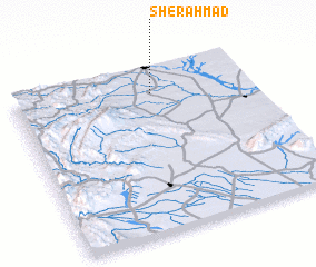 Places with similar names to Sher Ahmad, Pakistan ::
// Tiourmit (MA)
// Ciaramiti (IT)
// Charāmaddi (BD)
// Char Mādia (BD)
// Char Matta (BD)
// Char Matua (BD)
// Char Matua (BD)
// Char Medua (BD)
// Chārmādi (IN)
// Cherambādi (IN)
Disclaimer :: Information on this page comes without warranty of any kind |
||
|
Where is Sher Ahmad? Elevation and coordinates ::
Latitude (lat): 32°50'50"N Longitude (lon): 70°34'55"E
Elevation (approx.): 328m (map arrows pan, magnifying glasses zoom) |
||
|
Visiting Sher Ahmad? Hotel/Accommodation ::
Book a hotel in Sher Ahmad Travel Guide ::
Buy a travel guide for Pakistan rental cars ::
car rental offers GPS waypoint ::
download a GPX waypoint (PoI) of Sher Ahmad for your GPS receiver
|
||