|
search place name
|
||
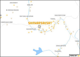
Shīn Warsak Sat (Federally Administered Tribal Areas, Pakistan)Shīn Warsak Sat is a town in the Federally Administered Tribal Areas region of Pakistan. An overview map of the region around Shīn Warsak Sat is displayed below.
regional and 3d topo map of Shīn Warsak Sat, Pakistan ::
Shīn Warsak Sat airports ::
The nearest airport is PZH - Zhob, located 101.5 km south of Shīn Warsak Sat.
Other airports nearby include PEW - Peshawar Intl (266.6 km north east), Nearby towns ::
Wucha Kasa (0.6km south west) //
Jindai (0.7km south west) //
Kurezai (0.9km east) //
Changai (1.3km south east) //
Gangi Khel (1.4km north) //
Pora (1.3km east) //
Kuti Kili (1.7km south) //
Boki Kasa (1.5km south east) //
Kundi Kasa (1.8km south) //
Ghwāya Kho (2.0km south) //
Sperki Wāla (2.0km south east) //
Dotāni Kot (2.5km south east) //
Karai (2.6km east) //
Dab Kili (2.9km north east) //
Toji Khel (3.1km south east) //
Mukhai Faqīr (3.7km south west) //
Kaskai (3.7km east) //
Dāg (3.8km east) //
Khojal Khel (4.1km north east) //
Tsappar (4.2km east) //
Sherana (4.6km east) //
Karīm Khān (4.7km east) //
Kibarai (4.8km south west) //
Pīr Makān (4.8km east) //
Wāna (5.6km north east) //
Tāran (5.4km east) //
Kabali Kili (5.4km east) //
Shahwula (5.7km east) //
Ghalja (6.0km east) //
[all distances 'as the bird flies' and approximate] 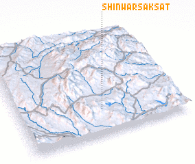 Places with similar names to Shīn Warsak Sat, Pakistan :: Disclaimer :: Information on this page comes without warranty of any kind |
||
|
Where is Shīn Warsak Sat? Elevation and coordinates ::
Latitude (lat): 32°16'20"N Longitude (lon): 69°31'15"E
Elevation (approx.): 1424m (map arrows pan, magnifying glasses zoom) |
||
|
Visiting Shīn Warsak Sat? Hotel/Accommodation ::
Book a hotel in Shīn Warsak Sat Travel Guide ::
Buy a travel guide for Pakistan rental cars ::
car rental offers GPS waypoint ::
download a GPX waypoint (PoI) of Shīn Warsak Sat for your GPS receiver
|
||