|
search place name
|
||
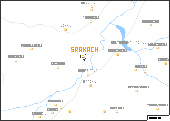
Sra Kach (Balochistān, Pakistan)Sra Kach is a town in the Balochistān region of Pakistan. An overview map of the region around Sra Kach is displayed below.
regional and 3d topo map of Sra Kach, Pakistan ::
Sra Kach airports ::
The nearest airport is PZH - Zhob, located 50.5 km north east of Sra Kach.
Nearby towns ::
Musāfirpur (3.1km south) //
Band Kili (5.7km south) //
Kazhbun (5.3km west) //
Musāzai Kili (6.3km east) //
Wuch Kili (7.8km north west) //
Pewar Kili (8.7km north) //
[all distances 'as the bird flies' and approximate]  Places with similar names to Sra Kach, Pakistan ::
// Syrkashi (RU)
// Šarkaičiai (LT)
// Surgučiai (LT)
// Zarkūsh (IQ)
// Sargāchhi (BD)
// Sarkutia (BD)
// Circasia (CO)
// Cerro Coache (MX)
// Ciriquicho (MX)
// Saracachi (MX)
Disclaimer :: Information on this page comes without warranty of any kind |
||
|
Where is Sra Kach? Elevation and coordinates ::
Latitude (lat): 30°59'40"N Longitude (lon): 69°8'40"E
Elevation (approx.): 1442m (map arrows pan, magnifying glasses zoom) |
||
|
Visiting Sra Kach? Hotel/Accommodation ::
Book a hotel in Sra Kach Travel Guide ::
Buy a travel guide for Pakistan rental cars ::
car rental offers GPS waypoint ::
download a GPX waypoint (PoI) of Sra Kach for your GPS receiver
|
||