|
search place name
|
||
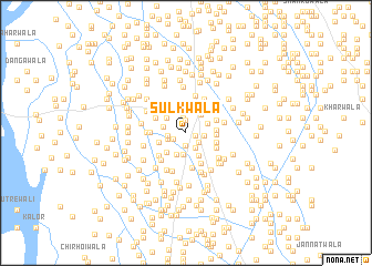
Sulkwāla (Punjab, Pakistan)Sulkwāla is a town in the Punjab region of Pakistan. An overview map of the region around Sulkwāla is displayed below.
regional and 3d topo map of Sulkwāla, Pakistan ::
Sulkwāla airports ::
The nearest airport is MUX - Multan Intl, located 44.7 km east of Sulkwāla.
Other airports nearby include PZH - Zhob (185.6 km north west), RYK - Rahim Yar Khan Sheikh Zayed (223.0 km south), SUL - Sui (252.9 km south west), Nearby towns ::
Chāndewāla (0.9km east) //
Tāhlīwāla (1.2km north) //
Ādilābād (1.2km south) //
Bhāgrīwāla (1.2km south west) //
Turkīwāla (1.4km south east) //
Fattūwāla (1.6km north) //
Jagtewāla (1.7km south east) //
Tibba Māchhīwāla (1.6km west) //
Dādwāla (1.6km east) //
Khokharwāla (1.7km west) //
Pīpalwāla (2.2km north) //
Bhari Hog (2.2km south) //
Sanāwān (2.3km north) //
Chhotewāla (2.3km south) //
Taiyabwāla (2.1km north east) //
Jhangwāla (2.1km west) //
Wiskanwāla (2.3km north east) //
Mīranwāla (2.3km north west) //
Pakkewāla (2.6km south east) //
Husainwāla (2.8km north) //
Buddhūwāla (2.7km south west) //
Sarīnwāla (2.9km north) //
Kassiwāla (2.6km west) //
Pīrwāla (2.7km east) //
Zindagiwāla (2.7km east) //
Poshīdewāla (2.8km east) //
Hāji Ishāqwāla (3.0km north west) //
Pāyānwāla (2.9km north east) //
Khewewala (3.1km north west) //
[all distances 'as the bird flies' and approximate]  Places with similar names to Sulkwāla, Pakistan ::
// Suili-Kiwele (CD)
// Sālakwāla (PK)
Disclaimer :: Information on this page comes without warranty of any kind |
||
|
Where is Sulkwāla? Elevation and coordinates ::
Latitude (lat): 30°18'10"N Longitude (lon): 70°58'10"E
Elevation (approx.): 125m (map arrows pan, magnifying glasses zoom) |
||
|
Visiting Sulkwāla? Hotel/Accommodation ::
Book a hotel in Sulkwāla Travel Guide ::
Buy a travel guide for Pakistan rental cars ::
car rental offers GPS waypoint ::
download a GPX waypoint (PoI) of Sulkwāla for your GPS receiver
|
||