|
search place name
|
||
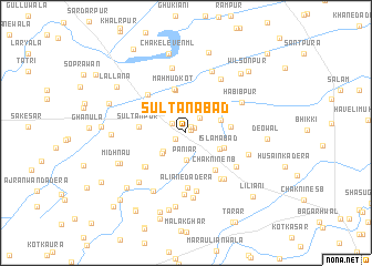
Sultānābād (Punjab, Pakistan)Sultānābād is a town in the Punjab region of Pakistan. An overview map of the region around Sultānābād is displayed below.
regional and 3d topo map of Sultānābād, Pakistan ::
Sultānābād airports ::
The nearest airport is LYP - Faisalabad Intl, located 99.8 km south of Sultānābād.
Other airports nearby include ISB - Islamabad Chaklala (151.6 km north), LHE - Lahore Allama Iqbal Intl (164.8 km south east), IXJ - Jammu (188.8 km east), ATQ - Amritsar (190.1 km east), Nearby towns ::
Gobindpura (0.5km north east) //
Roshanpura (0.7km north east) //
Bhalwāl (0.9km north east) //
Hayātpura (1.0km north west) //
Chak Eleven Shumāli (1.1km south west) //
Bhalwāl (1.5km north west) //
Jalālpur (1.9km north east) //
Paniār (2.7km south) //
Chak Ten NB (2.7km south west) //
Thatta Nau (2.9km south west) //
Pindi Rahīm (3.2km north east) //
Islāmābād (3.4km south east) //
Chak Seven SB (3.6km south east) //
Dhamman (4.4km north) //
Mahmūd Kot (4.5km north) //
Gujrānwāla (3.8km east) //
Chak Nine NB (4.5km south east) //
Sultānpur (4.1km west) //
Chak Biddulph (4.1km west) //
Shaikhpura Nau (4.9km south west) //
Chak Twenty-two NB (4.9km south west) //
Ali Tārāgarh (5.0km north west) //
Aliane da Dera (5.6km south) //
Ruknāna (5.5km south east) //
Sher Ali da Dera (5.9km south) //
Waliāna (5.7km south east) //
Shāhu da Dera (5.5km south east) //
Samiane de Dera (6.2km south) //
Habībpur (5.6km north east) //
[all distances 'as the bird flies' and approximate]  Places with similar names to Sultānābād, Pakistan ::
// Sultanabat (TR)
// Sultan-Abad (UZ)
// Sultanabad (UZ)
// Sultanabad (UZ)
// Solţanābād (IR)
// Solţānābād (IR)
// Solţānābād (IR)
// Solţānābād (IR)
// Solţānābād (IR)
// Solţānābād (IR)
Disclaimer :: Information on this page comes without warranty of any kind |
||
|
Where is Sultānābād? Elevation and coordinates ::
Latitude (lat): 32°15'40"N Longitude (lon): 72°53'35"E
Elevation (approx.): 193m (map arrows pan, magnifying glasses zoom) |
||
|
Visiting Sultānābād? Hotel/Accommodation ::
Book a hotel in Sultānābād Travel Guide ::
Buy a travel guide for Pakistan rental cars ::
car rental offers GPS waypoint ::
download a GPX waypoint (PoI) of Sultānābād for your GPS receiver
|
||