|
search place name
|
||
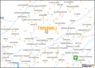
Tāngowāli (Punjab, Pakistan)Tāngowāli is a town in the Punjab region of Pakistan. An overview map of the region around Tāngowāli is displayed below.
regional and 3d topo map of Tāngowāli, Pakistan ::
Tāngowāli airports ::
The nearest airport is LYP - Faisalabad Intl, located 87.1 km south of Tāngowāli.
Other airports nearby include LHE - Lahore Allama Iqbal Intl (162.5 km south east), ISB - Islamabad Chaklala (165.4 km north), ATQ - Amritsar (190.4 km east), IXJ - Jammu (196.8 km east), Nearby towns ::
Chak Sixteen SB (2.4km north) //
Lūnda (2.8km south) //
Chak Fourteen SB (3.0km north west) //
Chak Seventy-two A SB (3.3km south) //
Amritsariān da Dera (3.1km north east) //
Khāriān (3.8km north) //
Pindi Wariach (3.8km south west) //
Chak Fourteen SB (3.9km north) //
Chirāgh Ali di Haveli (3.4km east) //
Chak Seventy-five SB (4.0km south west) //
Shero Dhok (3.6km east) //
Chak Seventy-two SB (4.1km south east) //
Kurāni (4.3km south east) //
Chak Seventy-five A SB (3.9km west) //
Kot Paira Rām (4.8km south) //
Risāla (4.6km north west) //
Chak Thirteen A SB (5.2km north east) //
Nuriwāla (5.6km north) //
Chak Thirteen SB (5.7km north) //
Chak Fifteen SB (5.3km north east) //
Moti di Haveli (5.8km north) //
Ajnāla (5.4km north west) //
Malakghar (5.5km north east) //
Chak Seventy-one SB (5.8km south east) //
Malakpur (5.8km north west) //
Dine ka Dera (5.5km east) //
Dhirke (6.0km south east) //
Chak Seventy-eight SB (6.4km south) //
Chak Twenty-six NB (6.3km north) //
[all distances 'as the bird flies' and approximate] 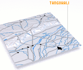 Places with similar names to Tāngowāli, Pakistan ::
// Tānkawāla (IN)
// Tūngawāli (IN)
// Tunggweli (GH)
// Dunukewala (LK)
// Dunukewela (LK)
// Tungwele (ZM)
// Dankawali (SL)
// Dankowolia (SL)
// Dangāwāla (PK)
// Dangowāla (PK)
Disclaimer :: Information on this page comes without warranty of any kind |
||
|
Where is Tāngowāli? Elevation and coordinates ::
Latitude (lat): 32°8'25"N Longitude (lon): 72°50'52"E
Elevation (approx.): 191m (map arrows pan, magnifying glasses zoom) |
||
|
Visiting Tāngowāli? Hotel/Accommodation ::
Book a hotel in Tāngowāli Travel Guide ::
Buy a travel guide for Pakistan rental cars ::
car rental offers GPS waypoint ::
download a GPX waypoint (PoI) of Tāngowāli for your GPS receiver
|
||