|
search place name
|
||
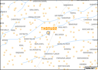
Thānwar (Punjab, Pakistan)Thānwar is a town in the Punjab region of Pakistan. An overview map of the region around Thānwar is displayed below.
regional and 3d topo map of Thānwar, Pakistan ::
Thānwar airports ::
The nearest airport is LYP - Faisalabad Intl, located 100.2 km north west of Thānwar.
Other airports nearby include LHE - Lahore Allama Iqbal Intl (129.2 km north east), ATQ - Amritsar (169.5 km north east), Nearby towns ::
Shāhkot (1.2km south west) //
Odānwāla (1.8km south) //
Phularwan Kamboh (2.0km north east) //
Kachcha Pakka (2.3km west) //
Lālūpur (2.9km north) //
Probynābād (3.4km south) //
Chak Baghela Khokhar (3.1km north east) //
Chāh Shāmā Kamboh (3.6km north east) //
Dīlewāli (3.2km south west) //
Bhagwānpura (3.2km west) //
Naththu Shāh (3.7km north east) //
Bel Singh (3.7km east) //
Sukhpur (4.5km south) //
Kot Nabi Bakhsh (4.4km north east) //
Retpur (4.5km south) //
Tulla Kamboh (4.2km south east) //
Thatta Pīrān (4.6km south) //
Thākar Singhwāla (4.7km south) //
Chaplīpur (4.8km north) //
Surjankot (5.0km north) //
Nawankot Lāla (4.7km west) //
Būhlewāl (5.4km south west) //
Chak Nihā Tejeka (5.2km north west) //
Sadullāpur (5.2km south west) //
Imbli Moti (5.1km east) //
Chak Forty-seven (6.0km north) //
Mirzāpur (5.8km north east) //
Gudāra (5.6km east) //
Shāh Nawāz Khān (6.5km south) //
[all distances 'as the bird flies' and approximate] 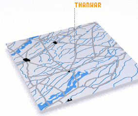 Places with similar names to Thānwar, Pakistan ::
// Thanwara (MM)
Disclaimer :: Information on this page comes without warranty of any kind |
||
|
Where is Thānwar? Elevation and coordinates ::
Latitude (lat): 30°36'25"N Longitude (lon): 73°33'55"E
Elevation (approx.): 171m (map arrows pan, magnifying glasses zoom) |
||
|
Visiting Thānwar? Hotel/Accommodation ::
Book a hotel in Thānwar Travel Guide ::
Buy a travel guide for Pakistan rental cars ::
car rental offers GPS waypoint ::
download a GPX waypoint (PoI) of Thānwar for your GPS receiver
|
||