|
search place name
|
||
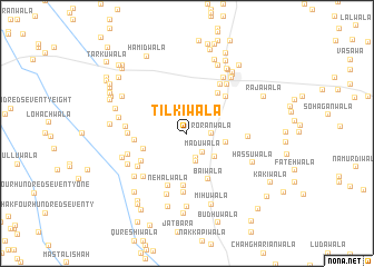
Tilkiwāla (Punjab, Pakistan)Tilkiwāla is a town in the Punjab region of Pakistan. An overview map of the region around Tilkiwāla is displayed below.
regional and 3d topo map of Tilkiwāla, Pakistan ::
Tilkiwāla airports ::
The nearest airport is MUX - Multan Intl, located 72.5 km south of Tilkiwāla.
Other airports nearby include LYP - Faisalabad Intl (156.1 km east), Nearby towns ::
Maduwāla (2.3km south east) //
Rorānwāla (2.1km east) //
Badiwāla (2.6km south) //
Samtiānwāla (2.9km south) //
Sahāranwāla (3.3km south east) //
Khajjiwāla (3.5km north east) //
Malūkāwāla (3.4km east) //
Gajawāla (4.0km south west) //
Sohbawāla (4.8km north east) //
Bāiwāla (5.0km south) //
Gulābwāla (5.3km south) //
Shāhwāla (4.6km west) //
Pathānwāla (5.0km north east) //
Jothanwāla (4.9km south west) //
Nehālwāla (5.5km south) //
Sāhuwāla (5.0km west) //
Miānwāla (5.9km south) //
Chaubāra (5.7km north east) //
Chathawāla (5.4km south west) //
Hasanwāla (5.7km south west) //
Ahmadwāla (5.3km east) //
Chak Four Hundred Eight (5.3km west) //
Nangwāla (5.5km south west) //
Jahāniāwāla (6.0km north east) //
Muhammadiwāla (6.4km south) //
Kulangwāla (5.9km south west) //
Pir Shāhwāla (6.4km north east) //
Hayāywāla (6.2km south west) //
Ukahanwāla (6.1km south west) //
[all distances 'as the bird flies' and approximate]  Places with similar names to Tilkiwāla, Pakistan ::
Disclaimer :: Information on this page comes without warranty of any kind |
||
|
Where is Tilkiwāla? Elevation and coordinates ::
Latitude (lat): 30°51'20"N Longitude (lon): 71°28'10"E
Elevation (approx.): 143m (map arrows pan, magnifying glasses zoom) |
||
|
Visiting Tilkiwāla? Hotel/Accommodation ::
Book a hotel in Tilkiwāla Travel Guide ::
Buy a travel guide for Pakistan rental cars ::
car rental offers GPS waypoint ::
download a GPX waypoint (PoI) of Tilkiwāla for your GPS receiver
|
||